



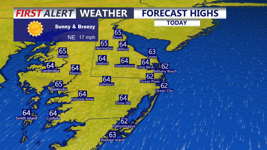

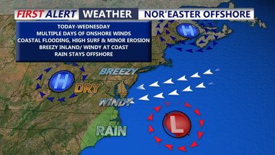
DELMARVA -- Marvelous Monday on Delmarva, mostly sunny skies and highs in the low to mid 60s. Breezy winds inland 25 to 30 mph, at the coast winds gust 35 mph+ out of the north northeast. Tonight a mostly clear and breezy night falling into the upper 40s to low 50s.

Highs in the low to mid 60s under sunny skies, winds will gust to 35 mph especially at the coast.
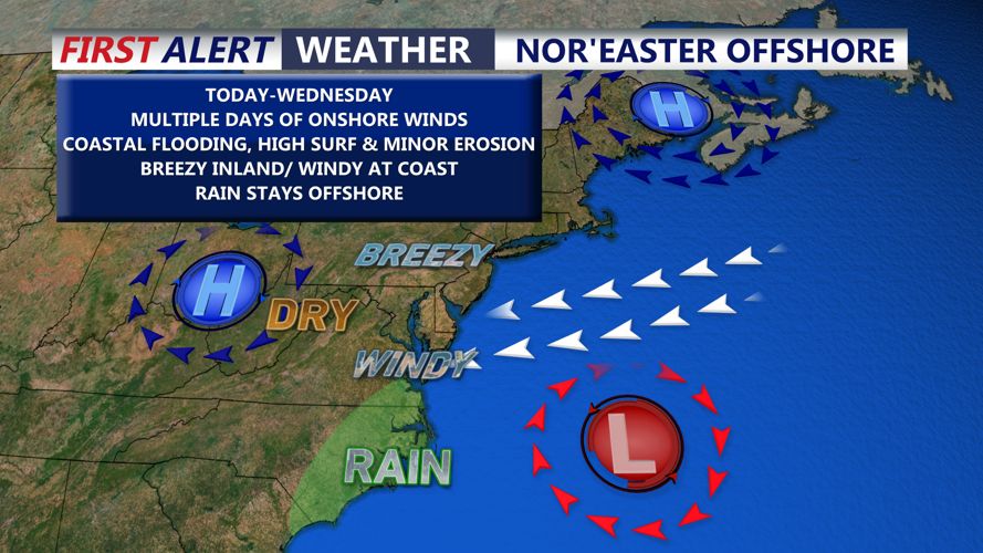
A developing coastal storm well out in the Atlantic will continue to spin and meander offshore through midweek. This will bring coastal flooding concerns, windy conditions at the beaches, high surf and beach erosion through Wednesday. The system will be far enough offshore that no rain is expected form this low pressure system. High pressure over the Ohio Valley is keeping the system from pushing west and keeping a lot of dry air in place.
In fact the National Hurricane Center has a 40 percent chance of this low becoming a subtropical low, in fact if it does it will be named Subtropical Storm Josephine. Either way will see the same impacts from this system
Tuesday will be absolutely beautiful with highs in the mid to upper 60s, it will remain breezy especially at the coast with gusts 35 mph.

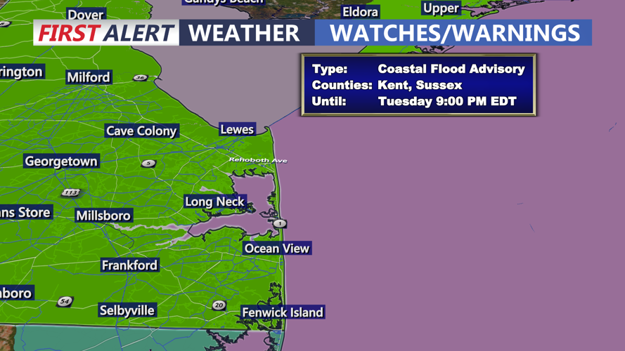
Coastal Flood Advisory goes into effect for Sussex and Kent Counties Tuesday 3pm-9pm.
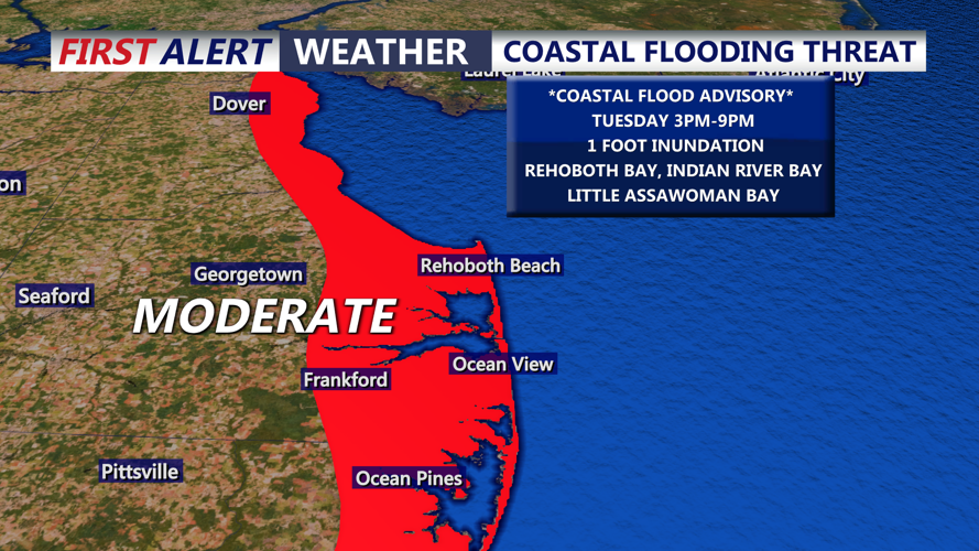
Coastal Flood Advisory is up for Kent and Sussex Counties from Tuesday 3PM-9PM Tuesday, MODERATE coastal flooding up to a foot of inundation through high tide cycles beginning Tuesday. Gale Warnings are also up through Wednesday for the entire Delmarva Coast. High surf is expected through Wednesday with wave heights up to 5 to 10 feet.

MODERATE coastal flooding will being during high tide Tuesday, up to a foot of inundation possible.
As far as weather conditions are concerned high pressure will remain in control through the end of the week and into the weekend expecting lot's of sunshine and dry conditions. Highs will remain in the 60s, slightly cooler into the weekend with highs in the upper 50s to low 60s. Overall staying drier than normally as we round out October.
