


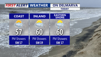

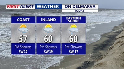
DELMARVA -- Cloudy skies won’t stop temperatures from climbing today as warmer air surges in ahead of a strong storm system pushing toward the Upper Great Lakes. With high pressure parked offshore, Delmarva sits in a breezy warm sector—expect highs in the mid to upper 50s, and near 60° in a few spots away from the coast, where cooler marine air won’t be as much of a factor. Southwest winds will be noticeable, frequently gusting 25 to 30 mph.
A warm front tied to that Great Lakes storm will sweep through today into tonight. While widespread rain is not expected this evening, a spotty shower or sprinkle can’t be ruled out. Otherwise, it’s a damp, balmy night with patchy fog developing, especially in areas prone to reduced visibility. Overnight lows settle into the upper 30s to low 40s.

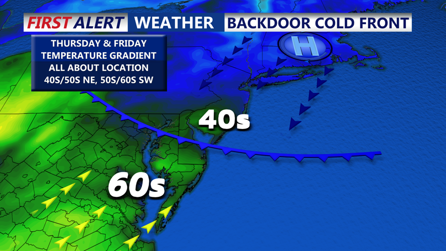
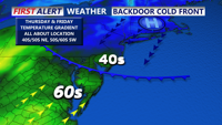
Expect cooler conditions Thursday with onshore winds keeping temperatures in the 40s/50s, slightly milder southwest portions of Delmarva.
On Thursday, a backdoor cold front pushes in from the northeast, flipping winds more onshore and bringing slightly cooler air, especially for the northern half of Delmarva. Highs will vary quite a bit: 40s and 50s north, while southern portions of the peninsula stay milder at 50s to near 60°.

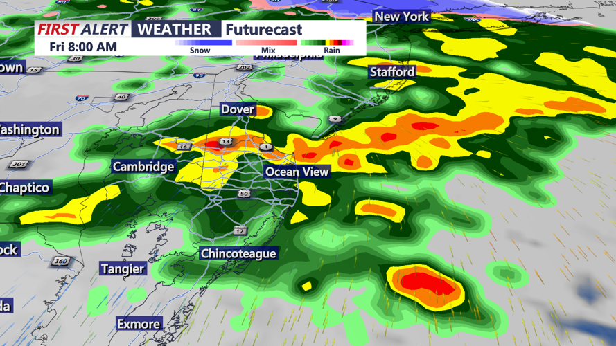
On and off rain late Thursday night into Friday, some rain could be heavy at times.
Thursday Night into Friday another low pressure system is expected to impact the region, with forecast guidance suggesting multiple areas of low pressure—one tracking across the lower Great Lakes and another closer to the Mid-Atlantic. Moisture overruns cooler air near the surface, leading to a period of rain arriving Thursday night and continuing into Friday morning. Expect on-and-off rain at least through the first part of Friday, with rainfall totals generally around one-half inch to one inch. Despite the rain, temperatures stay on the mild side, rebounding to the mid to upper 50s.
The pattern briefly relaxes. Most of Saturday looks calm and dry with partly sunny skies and highs near the low 50s.
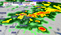
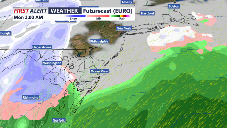
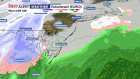
Sunday Night into Monday confidence drops late weekend into early next week. Forecast models continue to hint at a coastal low that could intensify as it exits off the northern Mid-Atlantic coast. If the storm’s track comes close enough and enough cold air is in place, there is potential for rain to change to snow, and possibly accumulating snowfall somewhere on Delmarva. However, the track and strength are still uncertain, and guidance has recently trended a bit farther south and east, which could reduce impacts locally. Bottom line it’s too early for specifics—expect adjustments over the next several days.

Watching a potential coastal storm late Sunday -Monday.
Early next week regardless of how the late-weekend system evolves, colder air looks to follow, with highs trending down into the 30s and 40s.
