


DELMARVA - A weak boundary continues to move offshore, trailing behind it the last remnants of earlier cloud cover and scattered showers. While most of the earlier rainfall has ended, Sussex County could still experience a few isolated showers or thunderstorms into the evening. Atmospheric conditions may briefly become unstable as a cold front approaches, allowing for the slim chance of a strong or even severe storm. However, limited instability overall should prevent widespread severe activity. Behind the cold front, skies will begin to clear, and drier air will filter in overnight. Expect low temperatures to dip into the mid-50s to mid-60s by early Wednesday.
Wednesday:
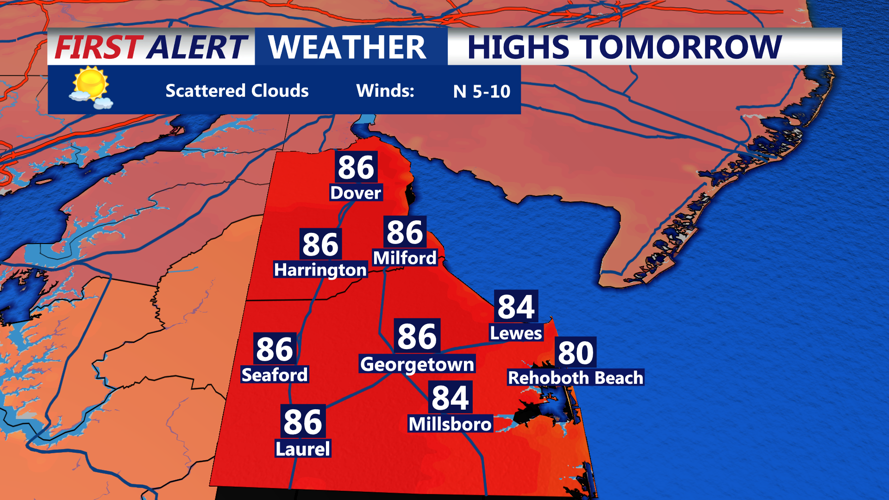
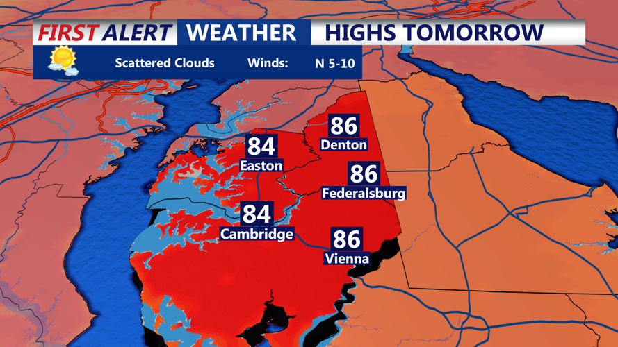
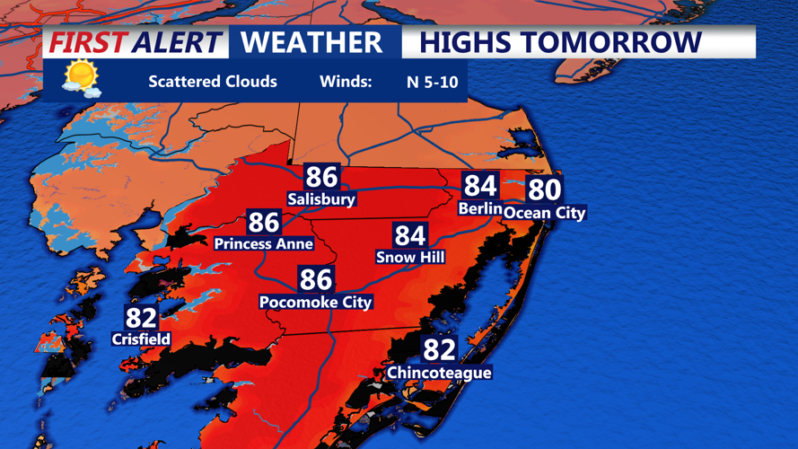
High pressure builds in from the west, ushering in clear skies and comfortable conditions. The air will feel noticeably drier, and residents can enjoy mostly sunny skies with temperatures climbing into the upper 70s and mid-80s. Light winds and lower humidity will make for a pleasant day across the county. By evening, skies remain clear and tranquil with lows in the low to mid-60s.
Thursday:
The warming trend continues into Thursday with a strengthening west/southwest flow pushing highs into the mid to upper 80s, making it one of the warmest days of the season so far. Despite the heat, humidity levels will stay relatively manageable, keeping heat index values only slightly above actual air temperatures. A shortwave trough approaching from the northwest may stir up a few isolated showers or thunderstorms—mainly confined to areas farther inland or north—but Sussex County is likely to remain dry. The night will be mild with partly cloudy skies and lows in the upper 60s.
