




DELMARVA - A stretch of quiet, increasingly mild November weather will continue across Sussex County through Tuesday evening, although areas of overnight fog could create reduced visibility for drivers during the Tuesday morning commute.
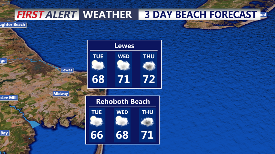
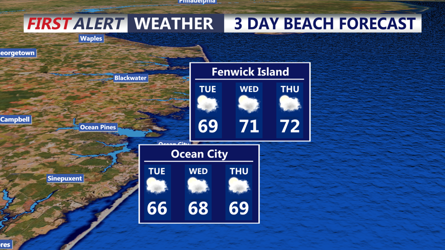
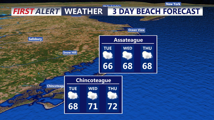
High pressure will remain in control across Delmarva, providing generally dry conditions through the middle of the week. Temperatures will continue climbing above seasonal averages, with afternoon highs Tuesday reaching the upper 60s to lower 70s across much of Sussex County.
Communities including Georgetown, Seaford, Millsboro and Laurel can expect a pleasant afternoon, while coastal locations such as Lewes, Rehoboth Beach, Bethany Beach and Fenwick Island will experience similarly mild conditions with occasional high clouds.
The primary weather concern will be the potential development of fog late Monday night into early Tuesday morning. Light winds, increasing moisture and relatively clear skies will create favorable conditions for fog formation, particularly across the coastal plain.
Some locations could experience locally dense fog, reducing visibility along Route 1, Route 113, Route 13 and other major highways. Fog may linger beyond sunrise, with gradual improvement expected between 8 and 10 a.m. Tuesday. Drivers should allow additional travel time where visibility becomes limited.
Once the fog dissipates, Tuesday will feature a mixture of sunshine and high clouds, with light southerly winds generally between 5 and 10 mph. No significant weather hazards are anticipated during the afternoon or evening.
Tuesday night will remain relatively mild, with another opportunity for patchy fog developing overnight. Unlike recent colder nights, temperatures are expected to remain comfortably above freezing, eliminating concerns about frost or freeze conditions.
The warming trend will continue Wednesday, with afternoon highs climbing into the lower to middle 70s. Dry weather should persist throughout the day, making Wednesday potentially one of the warmest days of the week.
However, the extended period of tranquil weather will begin changing Thursday as a developing storm system and approaching cold front bring increasing clouds and renewed rain chances.
Showers could arrive as early as Thursday afternoon and continue into Friday. Rain probabilities across the broader region currently range from 50% to 70%, although the greatest chances are expected farther north and west of Sussex County. An isolated thunderstorm cannot be ruled out Thursday.
Uncertainty remains regarding the timing and coverage of rainfall because the approaching cold front has slowed compared with earlier expectations.
The weekend forecast remains somewhat unsettled, with a 20% to 30% chance of showers Saturday. Sunday currently appears drier, with rain chances below 10%, before another opportunity for showers develops early next week.
For boaters, favorable marine conditions are expected through Tuesday evening. Southerly winds will generally remain between 5 and 12 mph, with Atlantic seas ranging from 1 to 3 feet. No marine advisories are anticipated through Tuesday.
Marine conditions could become less favorable Thursday through Saturday, when seas may build to 3 to 5 feet, potentially requiring Small Craft Advisories.
For Sussex County residents and visitors, the immediate forecast offers another opportunity to enjoy unusually mild autumn temperatures, with morning fog serving as the main weather concern before rain chances return later in the week.
