


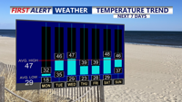

DELMARVA - A quiet but cold late Monday night across Sussex County is expected to give way to a modest warmup a weak weather system could still bring a round of light precipitation from Tuesday afternoon into Tuesday night.
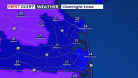
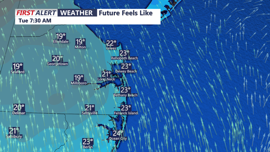
Overnight, calmer winds under high pressure are expected to help keep conditions stable, with temperatures dipping below freezing. Clouds are likely to increase into Tuesday, helping prevent another extreme cold morning, while also setting the stage for precipitation to arrive later in the day.
By Tuesday afternoon and evening, warmer air moving in above the surface is expected to nudge temperatures closer to seasonal norms. The incoming system will be fighting dry air, which should keep any precipitation light and spotty rather than widespread.
For Sussex County, the most likely outcome is light rain or drizzle at times Tuesday afternoon through Tuesday night, particularly as a warm front lifts through the region. Still, with nighttime temperatures expected to remain below freezing, residents and drivers are urged to watch for localized slick spots — especially on bridges, overpasses and lesser-traveled roads — if precipitation lingers after sunset.
A cold front is expected to cross the region Tuesday night, which could briefly enhance the chance of light precipitation before conditions dry out again. We caution that the overall setup appears weak, and small shifts in temperatures — especially near the surface — could influence whether precipitation falls purely as rain or briefly mixes with a light wintry component in isolated spots.
While the greater concern for a light glaze of ice is centered well to the north, officials say Sussex County should still plan for changing conditions Tuesday evening and overnight, even if impacts remain limited.
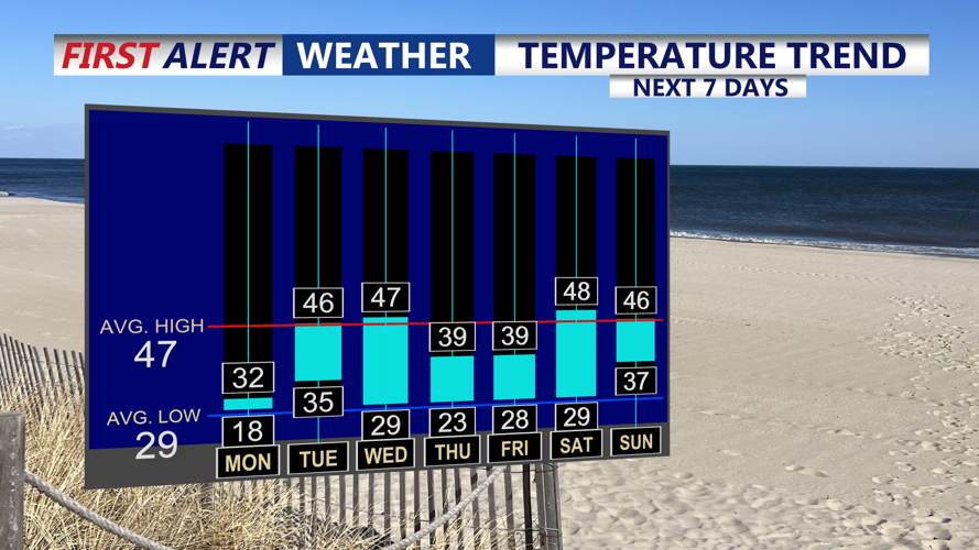
Looking ahead, temperatures are expected to stay closer to normal through midweek, with no additional cold-weather advisories anticipated in the coming days. Forecasters also say they are monitoring the potential for a separate system to affect the region over the weekend, though timing and precipitation type remain uncertain.