


DELMARVA - Heading into Wednesday, any morning fog should quickly burn off after daybreak, becoming clear. High pressure offshore will begin to move further out to sea, losing its control over our weather. By the afternoon, a pre-frontal trough will cross central Pennsylvania late in the day, potentially sparking a few showers and thunderstorms. However, the greatest forcing will be well to the north and west, making thunderstorm development more likely in those areas. A closed low is forecast to track just north of the Great Lakes Wednesday night into Thursday. Areas of convection are expected to be ongoing to our west with a cold front, which should reach our western and northern zones during the first half of Wednesday night. The intensity of the storms should decrease as they move eastward and the boundary layer stabilizes. However, a stronger storm could reach our zones before weakening.
Morning fog to clear, pre-frontal trough may bring showers Wednesday afternoon
-
Paul Williams
Chief Meteorologist
Paul Williams has earned Associated Press Chesapeake Bay Best Weather Anchor/Meteorologist for 2019, 2021, 2023, and serves as the chief meteorologist at CoastTV, delivering weather forecasts during the 5, 6, and 11 p.m. broadcasts.
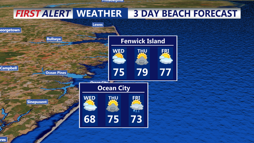
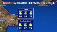
3 day beach forecast Ocean City
Paul Williams
Chief Meteorologist
Paul Williams has earned Associated Press Chesapeake Bay Best Weather Anchor/Meteorologist for 2019, 2021, 2023, and serves as the chief meteorologist at CoastTV, delivering weather forecasts during the 5, 6, and 11 p.m. broadcasts.
