


DELMARVA -- A strong area of Canadian high pressure centered near Hudson Bay is gradually pushing south through the Great Lakes into the Mid-Atlantic, reinforcing dry air and keeping conditions calm and dry the rest of Tuesday. High temperatures struggle to reach 70 degrees inland areas, with 60s for the majority of the area.

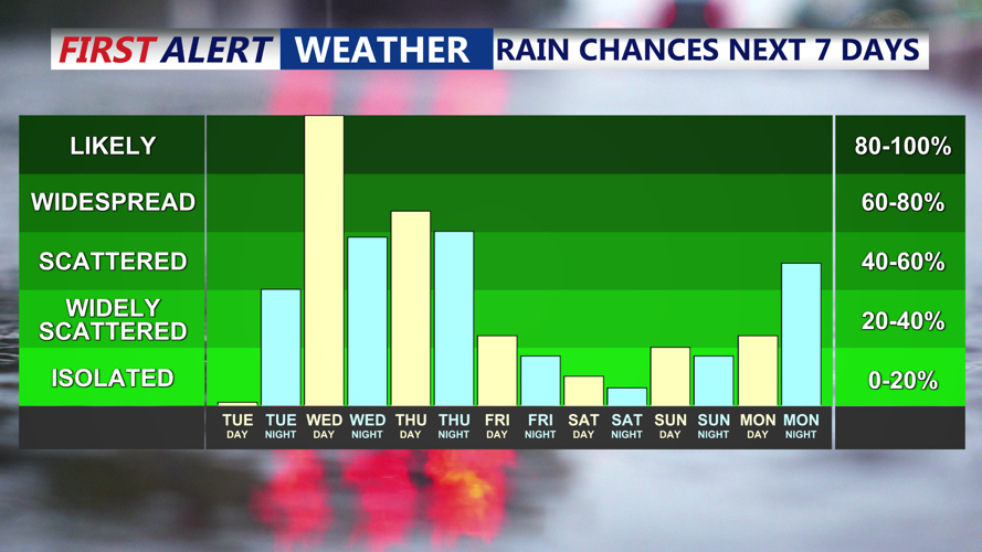
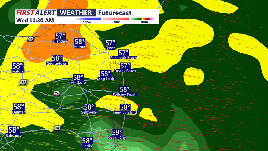
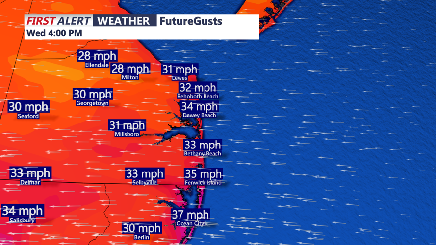
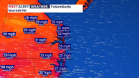
Clouds begin increasing Tuesday evening as the next weather system approaches from the southwest. By early Wednesday morning, widespread rain is expected across the region, with the potential for periods of heavier rain possible. A Yellow alert is in effect for the potential of heavy rain. Prepare for a wet morning rush hour with ponding on the roads expected. Highs will struggle to climb out of the 50s to low 60s on Wednesday, making for a noticeably cooler day. A raw easterly wind will gust over 30 mph at times, adding to the dreary conditions.

The steady rain becomes scattered showers Wednesday night with lows in the 50s.

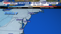
The unsettled conditions continue Thursday and are forecast to persist through the rest of the week. A new coastal low is expected to form off the Mid-Atlantic coast and track northeast into New England, continuing the threat of scattered showers into Friday. Highs will only be in the 60s the rest of the week, with chilly 50s at night.

A drying trend starts just in time for the Memorial holiday weekend. At this point it looks dry and pleasant Saturday through Memorial Day Monday. High temperatures will run below average with highs in the 60s and 70s, with lows in the 50s.
