




DELMARVA - A strengthening nor'easter off the Mid-Atlantic coast will bring increasingly windy conditions, dangerous surf and coastal flooding to the beaches Tuesday, with coastal impacts continuing into early Wednesday morning.
The National Weather Service in Mount Holly says the storm will remain well offshore, while generating persistent northeast winds that will push ocean water toward the coastline.
Tuesday morning will begin with generally dry conditions and periods of clouds, especially near the beaches. North-northeast winds will strengthen throughout the day, reaching 10 to 20 mph inland, with stronger gusts along the coast. Communities including Lewes, Rehoboth Beach, Dewey Beach, Bethany Beach, Fenwick Island, and Ocean City could experience wind gusts approaching 35 mph.
The greatest concern Tuesday will be coastal flooding during the evening high tide cycle.
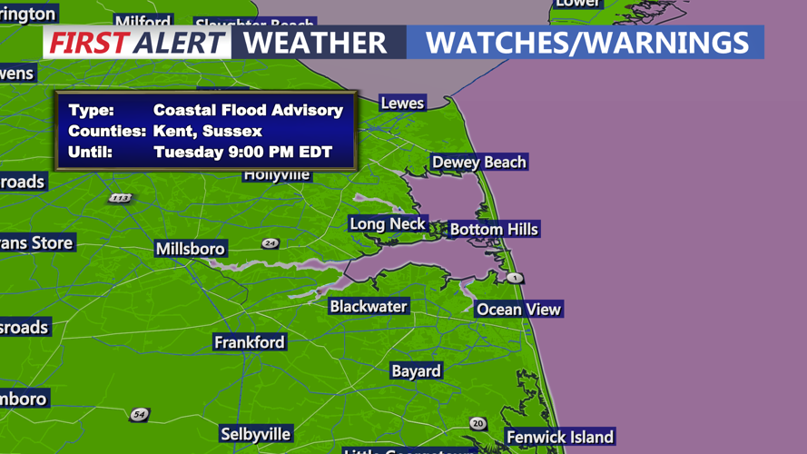
A Coastal Flood Advisory remains in effect from 3 p.m. until 9 p.m. Tuesday. Widespread minor tidal flooding is expected, particularly in low-lying coastal communities, along tidal waterways and near the inland bays.
Floodwaters could cover vulnerable roads, parking lots and other low-lying areas. Residents in flood-prone neighborhoods should prepare for elevated water levels and avoid driving through flooded streets.
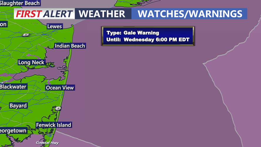
Dangerous marine conditions will also develop as the nor'easter strengthens offshore. Gale Warnings remain in effect for much of the Atlantic coastal waters, where wind gusts could reach 40 to 52 mph and wave heights could build to 8 to 12 feet during the storm.
The combination of strong onshore winds and building seas will increase the potential for beach erosion, especially around high tide. Beachgoers should stay away from the rough surf, while boaters are urged to remain in port until conditions improve.
Despite the significant coastal impacts, rainfall is not expected. Inland communities should experience mainly dry weather with breezy conditions and considerably fewer storm-related impacts.
Tuesday night into early Wednesday morning, persistent northeast winds will continue pushing water toward the coast, creating another opportunity for minor tidal flooding during the overnight high tide cycle. Additional Coastal Flood Advisories may be needed.
We expect coastal conditions to worsen further Wednesday as the offshore storm makes its closest approach to the region. Wednesday evening's high tide could produce widespread minor to locally moderate coastal flooding, making it the most concerning tidal cycle of the event.
The nor'easter is expected to gradually move farther offshore Thursday into Friday, allowing winds, seas and coastal flooding concerns to diminish.
Residents along the Atlantic beaches and inland bays should continue monitoring updated coastal flood advisories and prepare for several rounds of elevated tides through midweek.
