


DELMARVA -- Monday will start with some patchy fog across Delmarva, but it should quickly dissipate after sunrise. High pressure remains in control early in the week, keeping conditions dry and pleasant as it gradually shifts east through Tuesday.

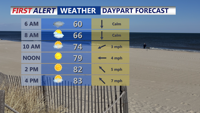
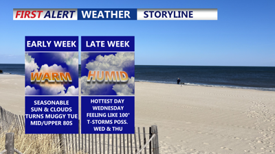
Patchy fog to start, mostly sunny and highs in the mid 80s, humidity still tolerable.
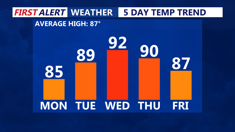
Monday’s forecast calls for mostly sunny skies and highs in the mid to upper 80s, with comfortable humidity levels. MODERATE rip current risk for the DE Beaches, LOW risk for Ocean City down to Chincoteague.

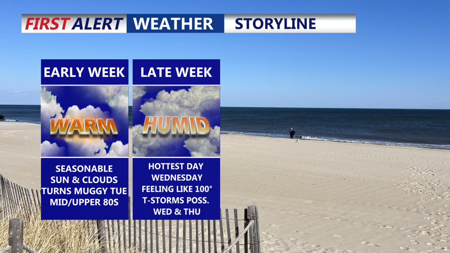
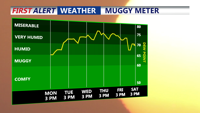
Uptick in humidity with each day this week, by Wednesday dew points are back in the 70s.
By Tuesday, a warmer and more humid air mass will settle over the region ahead of an approaching cold front. Inland highs will reach the upper 80s to low 90s, with slightly cooler conditions along the coast. Dew points in the 60s and low 70s could drop a bit during peak heating, keeping heat indices below advisory levels.

Temperatures will gradually rise each day, Wednesday will be the hottest day of the week.
On Wednesday, an upper-level trough glancing the area and a developing surface trough could trigger some late-day showers or thunderstorms. However, the overall coverage and strength of storms is uncertain. Temperatures will again be in the upper 80s to low 90s, with heat index values near 100 degrees possible.
A cold front will slide in from the northwest Thursday into Friday, possibly stalling or dissipating over the weekend. This front may bring a 20 to 30 percent chance of showers or thunderstorms Thursday, but most of the period will remain dry. Highs on Thursday are expected to be near 90 degrees inland, with dew points decreasing as the front moves through.
The weekend outlook calls for warm and mostly dry weather, with highs in the 80s to near 90 degrees and slightly lower humidity if high pressure builds in from the north.
