


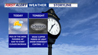


DELMARVA -- Afternoon highs climbing into the upper 30s to low 40s. It won’t be perfectly sunny, though—clouds will steadily increase through the day as a weak clipper system approaches.

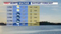
Temperatures rising to 40 today, clouds increase ahead of a round of light snow overnight.
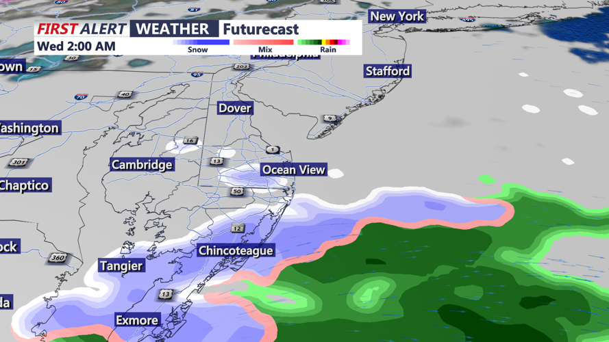
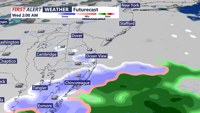
Tonight, temperatures drop into the mid to upper 20s. Light snow is expected to develop after midnight and should be out of here by daybreak Wednesday.

Period of light snow will move through overnight as a week clipper system pushes through.
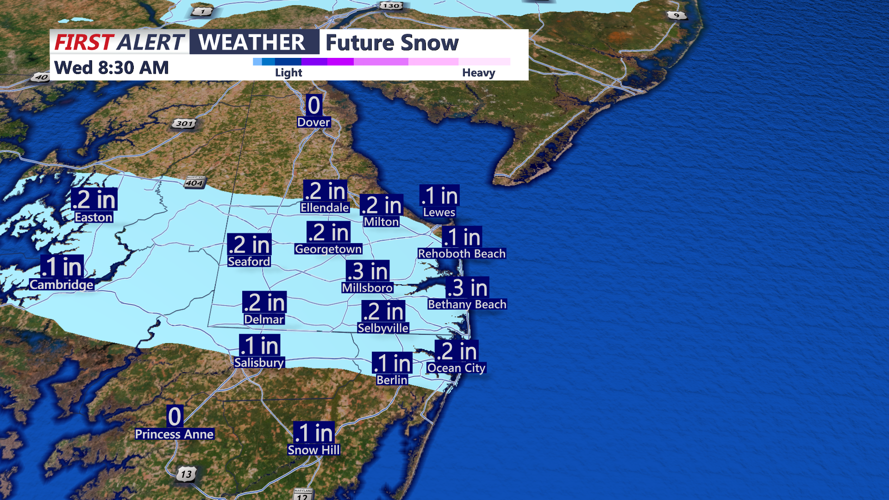
Accumulations look minor—generally an inch or less across the peninsula—but it may be enough to leave a coating on cars and a few slick spots for the Wednesday morning commute, especially on bridges, overpasses, and less-traveled roads.

Snowfall totals will very very light, less than an inch of accumulation peninsula wide.
Behind that system, the rest of the week turns seasonably cold. Highs will generally run in the low to mid 30s, with cold nights continuing.
The next chance for snow arrives possibly into Friday evening as a stronger clipper passes nearby and an Arctic front moves through. It’s still too early for exact totals or timing, but a period of light snow and/or bursts of snow squalls looks possible. Another reinforcing Arctic front follows Friday night.
Heading into the weekend and early next week, the cold intensifies. Highs are projected to fall back into the teens and 20s, with lows mainly in the single digits and teens. By the weekend, some spots could dip to near zero—or even as low as 5 below zero—with wind chills returning to dangerously cold levels.