


DELMARVA -- A calm, crisp night settles over Delmarva this Saturday, as low pressure continues to exit toward the Canadian Maritimes and high pressure begins to build in from the north and west. Skies will be partly cloudy overnight, and temperatures will be cooler than average for late May. Residents across the region can expect overnight lows to dip into the upper 40s to low 50s, with west to northwest winds at 5 to 10 mph.
Sunday will bring improving weather with fewer clouds than Saturday and more subdued winds.

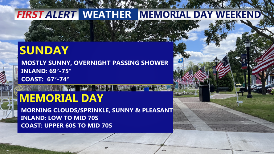
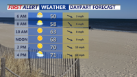
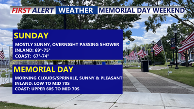
Mostly sunny skies with highs in the low 70s, late increasing clouds Sunday.
Expect west-northwest breezes around 10 mph, with occasional gusts reaching 15 to 20 mph. High temperatures will remain cooler than typical for this time of year, topping out in the upper 60s to low 70s across much of Delmarva.

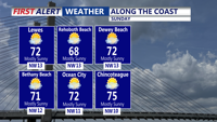
Mostly sunny skies Sunday with highs in the upper 60s to mid 70s.
High pressure continues its influence Sunday night into Monday, promoting mostly quiet conditions. However, a weak disturbance sliding south of the region could introduce some scattered showers to Delmarva late Sunday night. Rain chances remain modest at 20 to 30 percent, with most of the precipitation likely remaining south of the area.

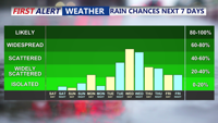
Showers chances ramp up Wednesday into Thursday.
Memorial Day will be a pleasant day across the region, with partly to mostly sunny skies and seasonable temperatures. Inland areas can expect highs in the low to mid 70s, while coastal communities remain slightly cooler in the upper 60s to low 70s due to developing sea breezes under light wind conditions.
Skies will remain mostly clear into Monday night as high pressure crests over the region. Overnight lows will range from the mid-40s to mid-50s, setting the stage for another dry and mild day Tuesday.
By Tuesday, high pressure begins to retreat eastward as the next weather system approaches from the Midwest. While the day will likely remain dry, mid- and high-level clouds will increase through the afternoon. Highs will be similar to Monday, generally in the low to mid 70s, though cooler along the coast.
Rain returns to the forecast Tuesday night into Wednesday, as low pressure tracks eastward. Forecast models vary on the timing and intensity of the system. Some solutions, like the GFS, suggest a fragmented, quick-hitting batch of rain late Tuesday into early Wednesday. Others, including the ECMWF and GEM, support a more consolidated and prolonged period of unsettled weather lasting through much of Wednesday.
Regardless of the model outcome, at least some rain is likely by midweek.
Looking ahead to Thursday and beyond, another cold front may sweep through the area, bringing additional chances for showers and thunderstorms. By Friday and into the weekend, a new upper-level low may drift south and east, continuing the risk for scattered showers—especially in the afternoon and evening hours.
While the period from Tuesday night through Saturday appears generally unsettled, it will not be a washout. As the week progresses, forecast confidence will improve in identifying windows of dry time and the best opportunities for precipitation.
