


DELMARVA - After a stretch of unsettled weather, Sussex County residents can look forward to refreshing changes starting late Sunday. A well-defined cold front will clear the area by evening, bringing an end to isolated showers and thunderstorms. While a few stronger cells are possible, the threat of severe weather remains minimal.
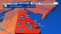
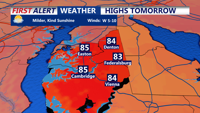
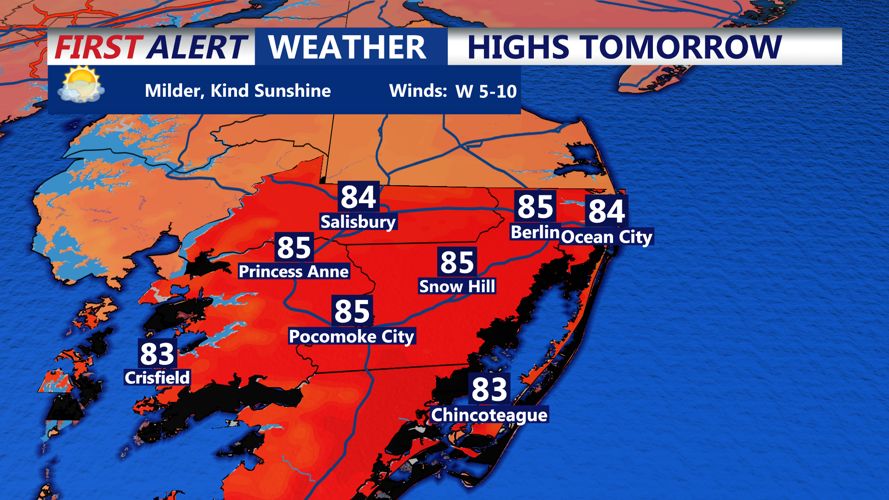
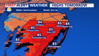
Once the front passes, much drier and cooler air will take hold. Overnight lows will drop to near 70 degrees across Sussex County, providing a noticeable break from recent humidity. High pressure building in from the northwest will dominate Monday’s weather pattern, delivering mostly sunny skies, a pleasant northwesterly breeze, and high temperatures in the mid 80s.
The cooler, more comfortable conditions will persist through Monday night, with dew points falling into the 50s and low 60s—creating crisp mornings and mild afternoons. This marks a welcome shift from the muggy pattern that has prevailed across the region.
Looking ahead, dry weather is expected to hold through Wednesday, but humidity and heat will gradually return by Thursday as high pressure moves offshore. A return to unsettled conditions and potential triple-digit heat indices is on the horizon by the end of the week.
