


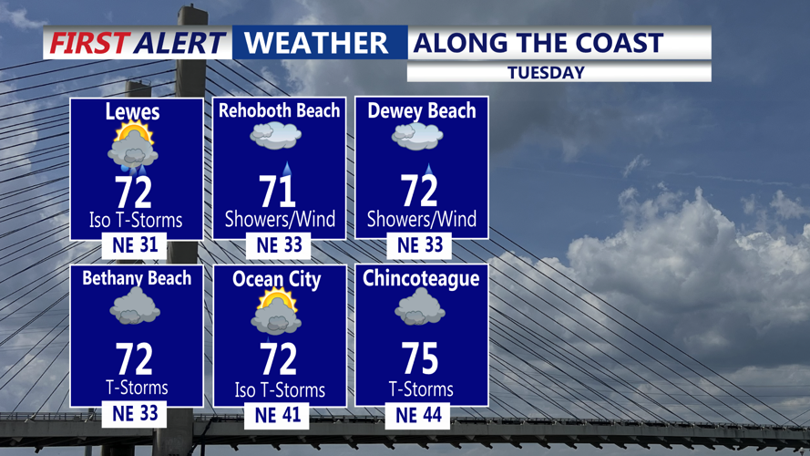


DELMARVA - Sussex County is in for a damp and breezy stretch as a coastal low spins offshore and creeps northward, bringing unsettled weather from early Tuesday through early Thursday.
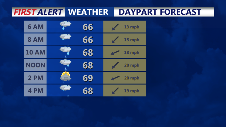
Forecasters said clouds will thicken and lower early Tuesday, with rain bands gradually moving across the Delmarva Peninsula through the day. The heaviest showers are expected Tuesday afternoon and evening, producing up to an inch of rainfall in some areas of southern Delaware. Brief, embedded thunderstorms may develop late Tuesday into Tuesday night, bringing locally heavy downpours and wind gusts.
East to northeast winds will freshen through Tuesday, averaging 10 to 15 mph inland and 15 to 20 mph along the coast, with gusts up to 25 to 35 mph possible near the shore. Temperatures will remain cool, with highs in the low 70s near the coast and mid to upper 70s inland, while nighttime lows settle in the upper 50s to low 60s.
By Wednesday, the weakening low is forecast to sit off the Virginia–North Carolina coast, still funneling moisture into the region. Scattered showers and a few thunderstorms are likely through Wednesday, especially across southeastern Delaware. Highs will hold in the upper 60s to lower 70s with overnight lows staying mild in the low to mid-60s.
Conditions should slowly improve late Wednesday into early Thursday as the system loses strength and moves away from the Mid-Atlantic. Forecasters expect fewer showers and increasing breaks of sunshine Thursday, with temperatures climbing into the upper 70s.
