


DELMARVA -- A stretch of unseasonably warm air will give way to a chilly and unsettled week across Delmarva, starting with a round of rain Sunday night and a noticeable drop in temperatures by Tuesday.

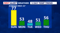
Big plunge in temperatures as we enter the second week of April.
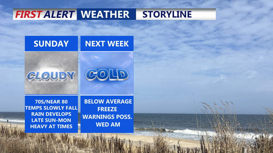
Sunday will begin mild and muggy with high temperatures peaking between 74 to 80 degrees inland and 68 to 74 along the coast. The warmest part of the day is expected from late morning into midday, ahead of an approaching cold front. Skies will remain mostly cloudy, and while a spotty shower or isolated thunderstorm cannot be ruled out during the afternoon, the bulk of the rain is expected to hold off until after sunset.

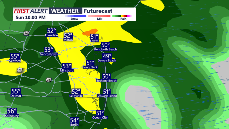
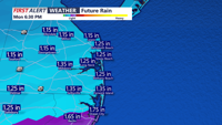
Expect rain to push into the peninsula Sunday night.
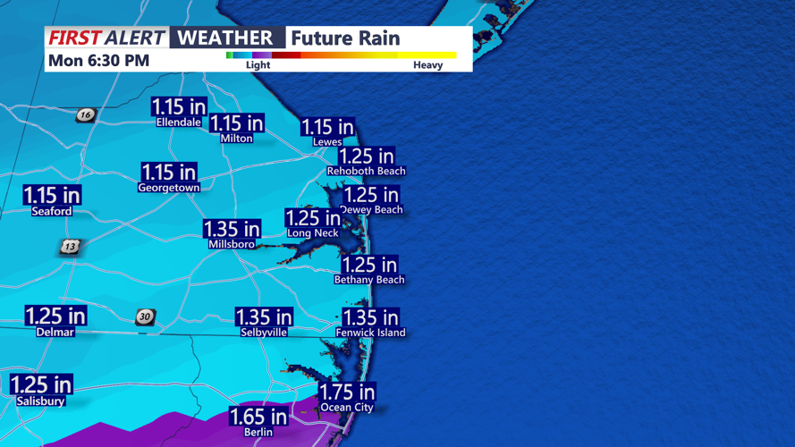
Rain develops Sunday night as a wave of low pressure tracks along the front. Rainfall is expected to become steadier and heavier at times through Monday morning, especially if localized thunderstorms enhance precipitation totals. Most areas can expect 0.75 to 1.25 inches, though locally higher amounts are possible. Low temperatures Sunday night will fall into the mid to upper 40s.

Rainfall totals Sunday night - Monday night.
Monday will feel much different, with daytime highs only reaching the low to mid-50s and rain tapering off from west to east by late afternoon. Behind the initial front, a second cold front arrives Monday night, though it is expected to bring little or no additional rainfall. However, temperatures will continue to drop, and Tuesday morning lows are forecast in the low to mid-30s across Delmarva.

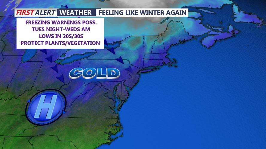
Cold dry Canadian air moves into the area Tuesday through Wednesday.
A strong upper-level trough will dominate the region through Tuesday, reinforcing the chilly pattern. High temperatures Tuesday will remain in the upper 40s to near 50, and gusty northwest winds between 25 and 35 mph will make it feel even colder. Dew points in the teens will create a dry environment, but where the growing season has started, a Freeze Warning may be necessary, as temperatures are expected to drop below freezing Tuesday night.
On Wednesday, cold air lingers as high pressure builds over the region. Daytime highs will hover near 50 degrees, and depending on wind speeds at night, frost or freeze conditions could develop once again across parts of Delmarva under clear skies and dry air.
By Thursday, the upper-level pattern begins to shift, and temperatures will gradually moderate. While Thursday may remain mostly dry, another round of rain is possible Friday as the next low-pressure system and cold front move in from the west. Southerly winds ahead of this system will help bring temperatures back toward seasonal averages to close out the week.