


DELMARVA -- As a strong cold front approaches Delmarva, expect increasing cloudiness tonight. Winds will gradually shift to the west and northwest as the front moves through. While no precipitation is forecast with the front, temperatures will dip below freezing across the region, reducing the risk of icy surfaces as conditions remain dry.

Rain changes to wintry mix late in the day.
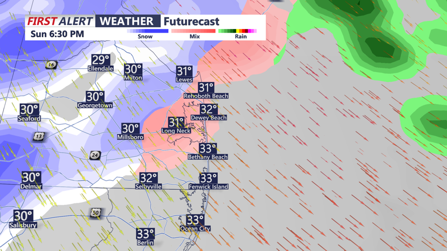
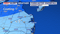
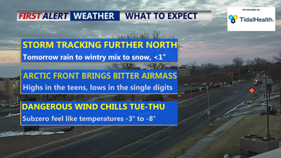
Sunday will bring the arrival of a low-pressure system developing along the stalled cold front. The system will move northeast, impacting Delmarva with a mix of rain, snow, and sleet. Precipitation will begin mid to late morning, intensifying through the afternoon and tapering off by Sunday evening. Coastal areas, including Ocean City and southern Sussex County, will see mostly rain changing to a mix of snow or sleet as colder air moves in.

Rain changes to sleet and snow late afternoon early evening
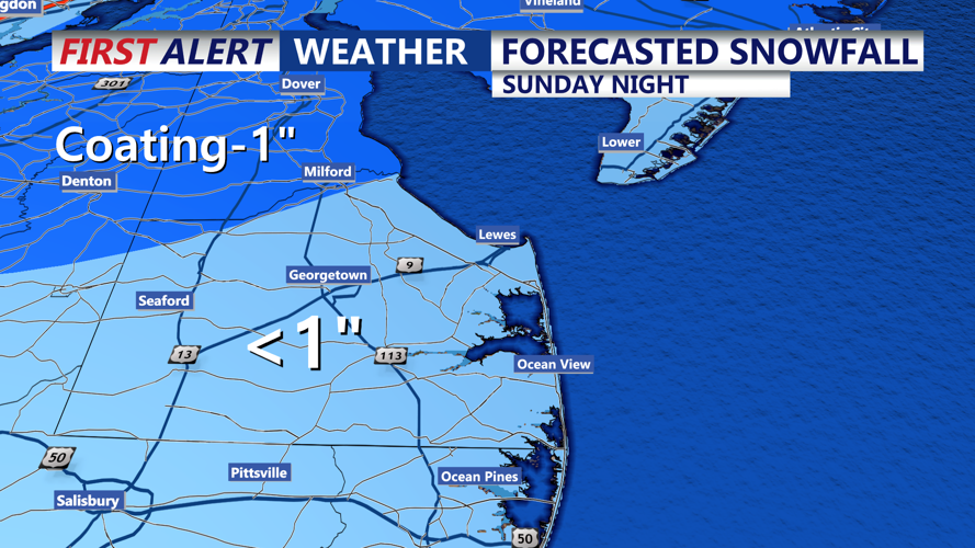
Inland areas begin with rain, transitioning to snow as temperatures drop later in the day. Coastal areas could see less than an inch of snow, while inland areas north and west of Delmarva may see a few inches of snowfall. This will be more of a nuisance system for our area.

Expected Snowfall Sunday Night
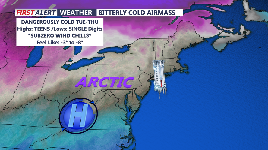
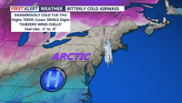
Behind the departing system, skies will begin to clear, and temperatures will plunge as an arctic air mass moves in. Overnight lows will drop into the teens, with wind chills falling into the single digits. Northwest winds may lead to blowing snow in areas with higher accumulations, creating icy and slippery conditions.

Dangerously Cold Air Moves In This Week
Subzero wind chills Monday night, ranging from 0 to minus 3, pose risks of frostbite and hypothermia. Infrastructure, such as water pipes, could also be affected by the extreme cold.
The arctic air mass will persist into Tuesday and Wednesday, with temperatures remaining well below normal. Lows will be in the single digits, and wind chills will stay dangerously low below zero. A slight chance of snow is possible late Tuesday into Wednesday as a low-pressure system brushes the area, but significant impacts are uncertain at this time.
By late week, temperatures will gradually moderate, but another system may approach Friday, bringing potential precipitation toward the weekend.
