


DELMARVA -- High pressure will take firm control of Delmarva’s weather beginning Saturday, bringing sunshine, cool temperatures, and crisp late-summer air.
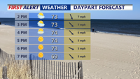
On Saturday, skies will be mostly sunny with highs running below seasonal averages. Northwest winds of 5 to 10 mph will keep conditions comfortable, and rip current risk remains LOW with ocean waves between 1 and 2 feet.
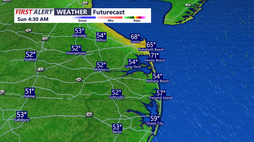
Clear skies and calm winds Saturday night will set the stage for the chilliest night of the season so far. Lows will dip into the low to mid-50s, and some inland areas could fall into the 40s.

Some areas could dip into the upper 40s away from the coast tonight.
Sunday’s forecast remains dry as high pressure shifts east and south. The weakening of an upper-level trough will allow more stable conditions to prevail. Sunshine is expected to dominate, with below-average temperatures continuing. A light sea breeze could develop during the afternoon along the coast.

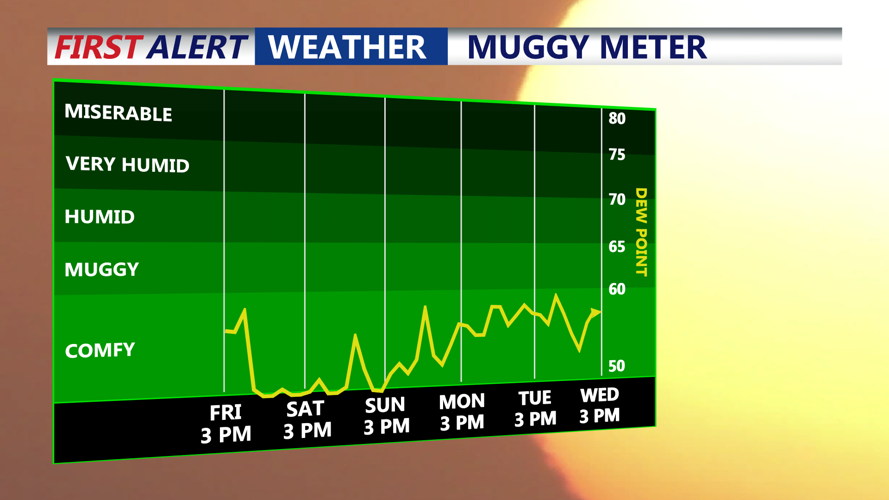
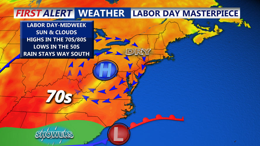
Cool comfortable airmass settles over Delmarva right through the holiday weekend.
Looking ahead, dry conditions are expected Labor Day through Wednesday as high pressure continues to influence the region.

High pressure in full control through next week.
Labor Day look for mostly sunny skies, with highs once again in the mid to upper 70s.
An area of low pressure forming off the Southeast coast is unlikely to affect Delmarva directly. While rain is needed, forecasters say the high will largely protect the area from any systems until later in the week. A slight chance of showers may arrive Wednesday night as moisture begins to creep northward.
By Thursday, an amplifying trough from the Midwest is forecast to push a cold front into the region. This will bring the next real chance for showers and possibly a thunderstorm, with rain chances projected around 40 to 50 percent. The timing of the front and the strength of the system remain uncertain.
