Storyline

Wall-to-wall sunshine Sunday, below average highs continue. Moderate rip current risk.

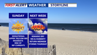
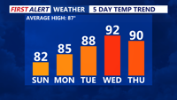
DELMARVA -- Sunday will be another gem across Delmarva, with high pressure delivering clear skies and below-average temperatures for early August. Afternoon highs will top out in the upper 70s to low 80s, well short of the seasonal average.

Sunday Daypart

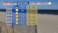
Sunny and beautiful Sunday with highs in the upper 70s to low 80s, humidity continues to be at comfortable level. 

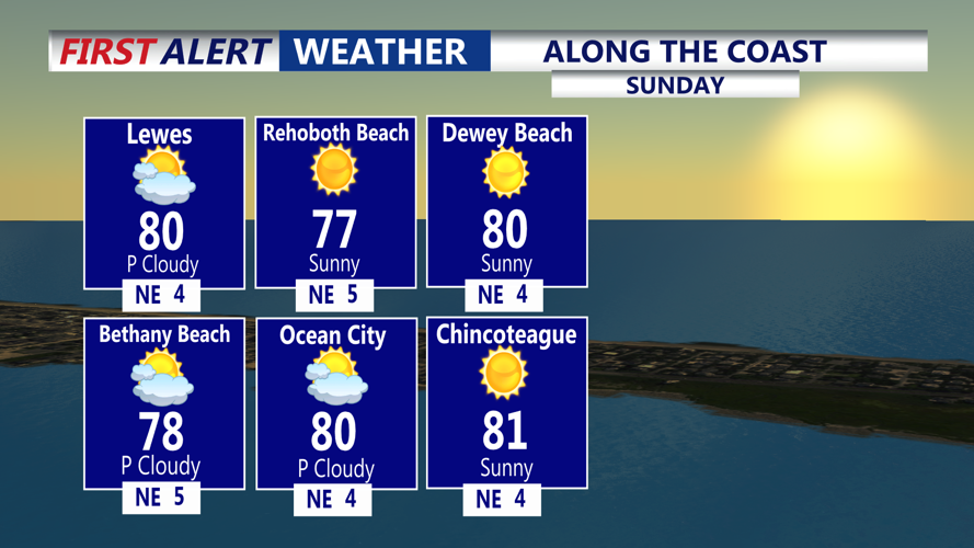
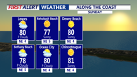
While it’s a perfect day to hit the shore, beachgoers should be aware of a MODERATE rip current risk from Delaware beaches south to Ocean City and Chincoteague. Officials advise swimming only in front of lifeguards and exercising caution in the water.

Along The Coast

Sunny skies, highs in the upper 70s to low 80s from Lewes to Chincoteague. 

Sunday night will bring another round of refreshing temperatures, with inland areas falling into the 50s and coastal spots staying in the 60s.

Get our all-good news weekly newsletter
FEEL GOOD FRIDAY
5 Day Temperature Trend

Seasonable temperatures to start the weekend, 90s make a return midweek. 

The stretch of tranquil weather will linger into Monday and Tuesday as high pressure slowly shifts east. This will also mark the beginning of a gradual warm-up, with highs climbing into the mid to upper 80s to near 90 by Tuesday. Dew points will be in the 60s, rising to the low 70s in parts of Delmarva on Tuesday, keeping heat indices just shy of advisory levels. Some patchy fog is possible late Monday night into early Tuesday morning.

By Wednesday, conditions will turn hotter and more humid. A surface trough is expected to develop across the region, combining with unstable air to spark scattered showers and thunderstorms, especially inland during the afternoon and evening. Highs will reach the low 90s, with dew points in the low 70s pushing heat indices near 100 degrees.

A cold front will arrive Thursday, bringing additional storm chances. Depending on cloud cover and rain, temperatures may ease slightly, but humidity will remain elevated. The front may stall over or near Delmarva into Friday and Saturday, leaving the region with lingering shower and thunderstorm chances. The end of the week will depend heavily on the front’s position, with some areas seeing cooler air while others remain unsettled.


Meteorologist

Chris Mastrobuono is a South Philly native, but has come to join the CoastTV meteorology team. With over three years of experience delivering accurate, passionate and insightful weather analysis, he is eager to report on the coast. Previously, he spent over two years as a morning meteorologist at WEVV CBS/FOX in Evansville, Indiana. 

Recommended for you