



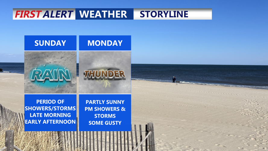
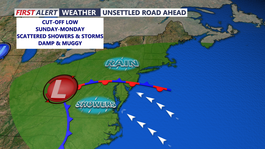

DELMARVA -- A mild and humid Saturday night will give way to widespread showers and possible thunderstorms by mid-morning Sunday, as a sprawling weather system takes hold over the Mid-Atlantic.
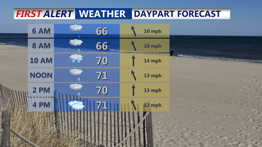
Temperatures overnight will remain in the 60s under thickening cloud cover, ahead of an upper-level disturbance pivoting out of the Ohio Valley. The system is expected to usher in waves of rain from southwest to northeast Sunday morning into early afternoon.
By late Sunday afternoon, conditions may begin to dry out from southwest to northeast. Still, highs are expected to be held in the 70s thanks to persistent cloud cover and a marine air influence from the southeast.
Looking ahead to Sunday night through Tuesday, a slow-moving closed low over the Ohio Valley will continue feeding energy into the region. Additional rounds of showers and scattered thunderstorms are likely, with the most consistent rainfall projected northwest of the I-95 corridor. Best opportunity for showers and storms Monday will be in the the afternoon through evening.
Highs Monday will be in the mid to upper 70s inland to lower 70s and 60s at the coast.
By Tuesday, an isolated shower or storm is possible but I think will begin to clear out through the afternoon and looking at mostly sunny skies by midweek.
By Wednesday, the low-pressure system is expected to lift out of the Northeast, but another cold front will quickly follow, pushing through the area into Thursday. Rain chances will decrease somewhat, but isolated showers and a few thunderstorms remain possible—especially if instability increases ahead of the front.
Friday could bring a noticeable cool-down if a stronger upper-level trough moves through the region. High pressure should begin building in by Saturday, helping to stabilize the atmosphere and usher in a stretch of drier weather.
Temperatures will moderate slightly next weekend, offering a more seasonal end to the unsettled week.
