


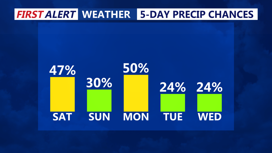
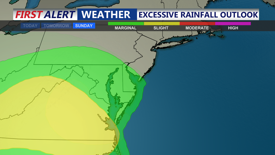


DELMARVA -- A round of showers and scattered thunderstorms is expected to develop Saturday afternoon and evening as a weak low-pressure system tracks along a stalled front draped over southern Delmarva. With precipitable water values between 1.7 and 2.0 inches, locally heavy rain may cause minor flooding in poor drainage areas, though the risk for flash flooding remains low.

Stalled front will bring the threat for showers and storms into early next week.
Afternoon highs Saturday will range from the low to upper 70s, with some areas possibly reaching 80 degrees before the rain sets in. Showers and storms may linger into the evening hours, followed by a cloudy and damp overnight period. Temperatures Saturday night will fall into the mid-60s.

Marginal risk of flooding on Delmarva, some localized flash flooding is possible where slow moving downpours occur.
The wet and unsettled pattern will persist through Monday. A combination of surface-level disturbances and weak upper-level energy will keep skies cloudy, conditions drizzly, and temperatures below average across the region. Highs on Sunday and Monday are expected to remain in the mid-60s to around 70, with overnight lows in the low to mid 60s. An onshore flow, depending on how far south the front dips, could make conditions feel even cooler, especially along the coast.

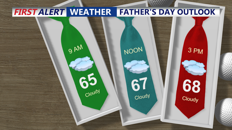
Cloudy Father's Day with most of the day being dry, better chance of rain comes Sunday night into Monday.
Although the overall impact from storms is expected to be minimal, the timing and intensity of any rain will be difficult to pin down due to a weak and quasi-zonal upper-level pattern through the weekend. A more defined shortwave trough is expected to approach Sunday night into Monday morning, increasing the chances for more widespread shower activity during that time frame.
Heading into the long term, the stubborn frontal boundary will finally begin to push offshore by Tuesday. Another weak system could bring spotty showers late Tuesday, but confidence in coverage remains low. As a Bermuda High strengthens offshore by midweek, warmer air will return to Delmarva.
By Wednesday, southerly flow will help temperatures rebound into the low to mid-80s. Thursday looks even warmer, with highs reaching into the low 90s in some inland areas. A few pop-up showers and thunderstorms are possible Thursday afternoon ahead of another cold front. Behind that front, Friday is expected to be drier and seasonably warm.
