


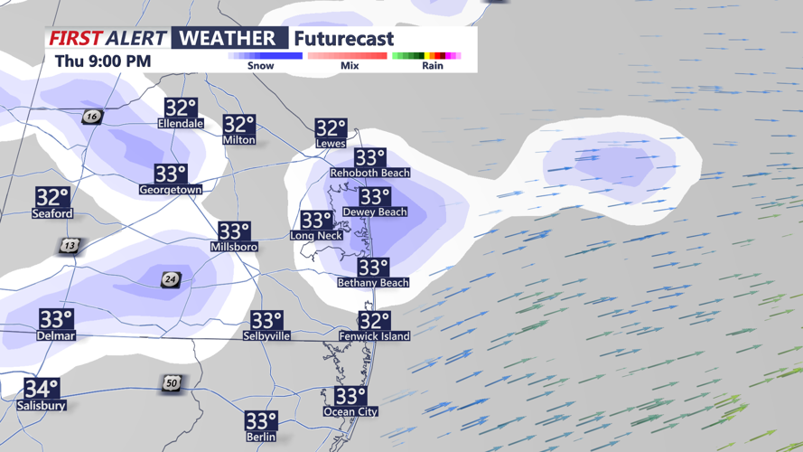


DELMARVA -- Tonight, will see light snow showers as a weak area of low pressure moves through the region. Accumulations are expected to be minor, and skies will clear overnight with temperatures dropping into the mid to upper 20s.

Few light snow showers through tonight
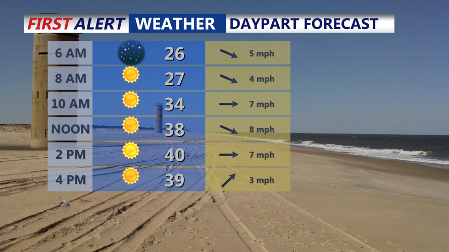
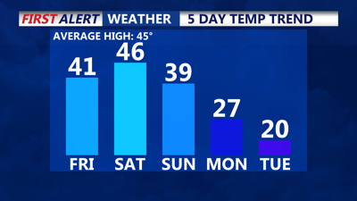
Friday offers a welcome break from the unsettled weather, with sunshine dominating the day and highs reaching near 40 degrees across much of the area. It’s expected to be the most pleasant day for outdoor activities in the coming week.

Mostly sunny skies Friday, get out and enjoy
By Saturday, a warm front will lift northward, bringing light rainfall and slightly milder temperatures, with highs in the mid to upper 40s. Precipitation will remain light, with shower activity persisting through Saturday evening.
A strong arctic cold front will arrive on Sunday, accompanied by a potential wave of low pressure that could bring a few inches of snow to parts of the region. While forecasts remain uncertain, any snowfall is expected to be light and short-lived.
Following Sunday’s cold front, a bitterly cold air mass will settle over the region early next week. Monday through Wednesday will see some of the coldest conditions so far this season, with highs struggling to reach 20 degrees in coastal areas and dropping into the single digits at night. Subzero wind chills ranging from -5 to -10 degrees are likely, particularly on Tuesday and Wednesday.
The dangerously cold conditions could lead to hypothermia, frostbite, frozen water pipes, and increased demand for heating energy. Residents are advised to take precautions for themselves and their pets, check on neighbors, and monitor weather updates as the situation develops.