


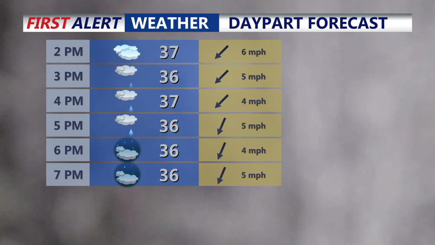


DELMARVA -- Surface high pressure will shift offshore today as a low pressure system lifts northeast off the Carolina coast and farther out to sea. With onshore flow increasing, a warmer layer of marine air will work its way into coastal areas, changing snowfall over to plain rain along the beaches through the afternoon. Inland, light snow remains possible, with most of Delmarva seeing up to an inch, and locally up to two inches across the southern Eastern Shore of Maryland. High temperatures will hold in the mid to upper thirties, reaching the low forties at the beaches.

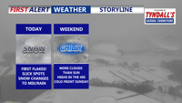
Cold raw afternoon and evening after morning snow, spotty snow shower, drizzle through the evening.
Tonight, low pressure near Cape Hatteras will track into the western Atlantic while an inverted trough pivots across the region. As temperatures fall into the upper twenties to low thirties, lingering low-level moisture and a subtle warm nose aloft could support pockets of drizzle or freezing drizzle through the evening. Roads may become slick in spots, especially inland.

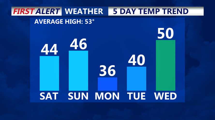
Chilly dry weekend, more clouds than sun, cold front pushes through late Sunday.
A mostly cloudy start to the weekend is expected. Saturday brings thick cloud cover and highs in the mid-forties. Southwesterly winds develop as the main trough sits northwest of Delmarva, allowing a brief warmup into Sunday, though temperatures will remain 5 to 10 degrees below normal for early March. Sunday turns partly sunny with highs again in the mid-forties. A cold front will sweep across the region late Sunday into Sunday night. Moisture looks limited, but northern areas of the wider Mid-Atlantic have a 20–30% chance for light snow along the frontal passage—little to no impact is expected for Delmarva.

Reinforcing shot of cold air arrives early next week.
Much colder air moves in Monday and Monday night, with temperatures running as much as 20 degrees below normal. Forecast lows Monday night may trend even colder if skies remain clear and winds stay light under nearby high pressure, setting up efficient radiational cooling.
Another low pressure system is expected to approach Wednesday into Thursday as the upper-level pattern reshuffles over eastern Canada and the Great Lakes. Forecast models show higher precipitation chances Wednesday night compared to previous runs, though track and timing remain uncertain. Temperatures may moderate slightly ahead of the system but will still trend below average for early March.
