


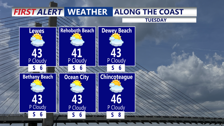


DELMARVA - Sussex County is expected to see a calm, cold start to Tuesday before clouds thicken and a weak weather system brings a chance of light precipitation into Tuesday night.
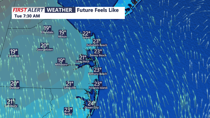
Early Tuesday morning, temperatures are expected to sit below freezing with light winds, reducing the bite compared with recent mornings. Cloud cover is expected to increase through the day as warmer air begins moving in aloft, helping temperatures climb closer to seasonal levels by afternoon.
The best chance for precipitation is expected to arrive later Tuesday and persist into the night as a warm front lifts through the region. Dry air in the lower atmosphere should limit how much precipitation develops, keeping any rain or drizzle generally light and intermittent rather than steady.
Even so, officials urged caution for Tuesday night travel. As temperatures fall back toward and below freezing after dark, any lingering drizzle could produce a few localized slick spots — most likely on elevated surfaces such as bridges and overpasses — though widespread icing is not expected in Sussex County.
A cold front is forecast to move through overnight Tuesday into early Wednesday. The frontal passage could briefly increase the chance of light precipitation, but the system is expected to remain weak, and forecasters said the overall moisture supply looks limited. Behind the front, temperatures are expected to slide back below freezing by early Wednesday morning, with precipitation tapering off.
Looking beyond early Wednesday, a more moderate temperature pattern is expected to hold through midweek, and no cold-weather advisories are anticipated. Forecasters also continue to monitor the potential for a separate system later this weekend, though confidence in timing and impacts remains low.
