


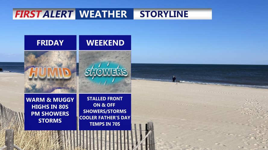


A stretch of warm, humid weather is expected to grip Sussex County from late Thursday through early Saturday, with the potential for showers and thunderstorms increasing as a weak cold front approaches.
Temperatures are forecast to climb into the upper 80s to near 90 degrees on Thursday, fueled by weak high pressure and light westerly winds. Dew points have been rising into the low to mid-60s, making conditions feel increasingly muggy. The National Weather Service reported that Philadelphia hit 90 degrees for the first time since Aug. 28.
By Thursday afternoon, cloud development along a slow-moving front in northern Pennsylvania and New York remained limited, and no thunderstorm activity had been detected. Surface convergence was minimal, despite rising instability and moderate wind shear aloft.
Any lingering showers or storms are expected to diminish after sunset as daytime heating fades. Overnight lows will remain mild, generally in the low 70s, as a weak cold front drifts through the region.
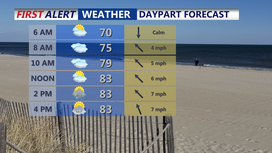
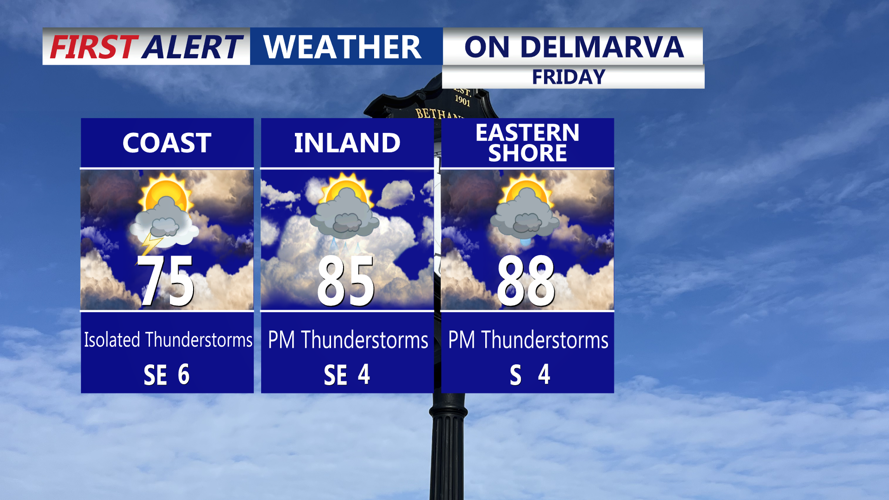
On Friday, weak high pressure will return temporarily, while an area of low pressure approaches from the southwest. This system will increase the chance of scattered showers and isolated thunderstorms during the day. Temperatures will dip slightly, with highs in the upper 70s along the coast and low to mid-80s inland.
Rain and storm chances will rise significantly Friday evening into Saturday morning as the low-pressure system tracks along the stationary front across the Mid-Atlantic. While widespread severe weather is not expected, locally heavy rainfall is possible due to high moisture content in the atmosphere. Precipitable water values (PWATs) are forecast to exceed 2 inches across parts of Delmarva.
Forecasters caution that while the overall weather pattern is relatively weak, some areas could experience downpours and gusty winds. Showers may persist into Saturday morning before a temporary lull in the afternoon, with another round of rain possible by evening.
The National Weather Service has placed Sussex County under a Marginal Risk for excessive rainfall through Sunday, signaling the potential for localized flooding.
Temperatures will trend cooler into the weekend, with highs in the low to mid-70s on Saturday and Sunday amid ongoing cloud cover and moisture-laden air. The unsettled pattern may continue into early next week as additional weak disturbances pass through the region.