



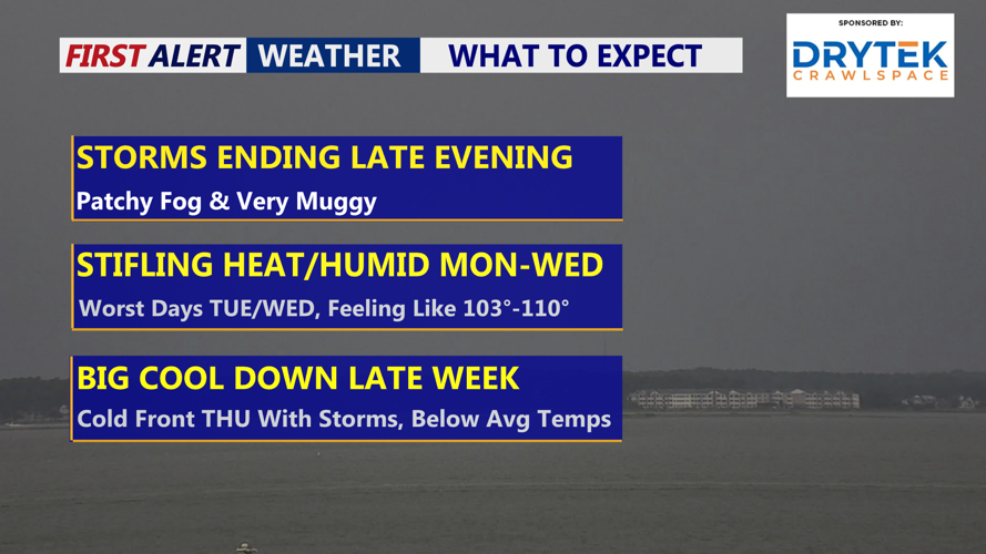

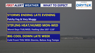
DELMARVA -- The peninsula baked under summer’s grip Sunday, with temperatures reaching 91 degrees in Georgetown before afternoon showers and thunderstorms swept across the region. Georgetown pick up 1.74 inches of rain from this afternoon's storms. Still have an isolated threat of a shower or storm through the evening but the threat will be diminishing late this evening.
Once storms move out, expect a muggy overnight under partly cloudy skies. Areas of fog are likely to develop by daybreak Monday as temperatures settle into the mid-70s.

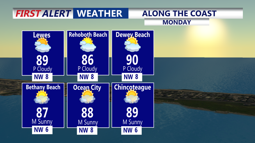
Mostly sunny hot and humid Monday, highs at the coast 86 to 90, inland 90-94, feeling like 100-103.
High pressure from the Ohio Valley is expected to build across the area Monday, ushering in mostly dry weather and hot temperatures. Dew points will remain in the low 70s, still uncomfortable but lower than recent days. Heat index values are expected to reach the upper 90s and lower 100s, just shy of heat advisory levels. Winds will turn north to northwest at about 10 mph, with a sea breeze developing along the shore in the afternoon. Highs Monday at the coast 86-91, inland 89-94.

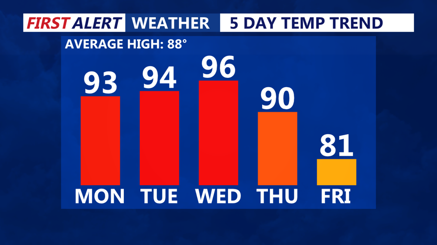
Temperatures rise into the mid 90s through midweek, big cool down comes late week.
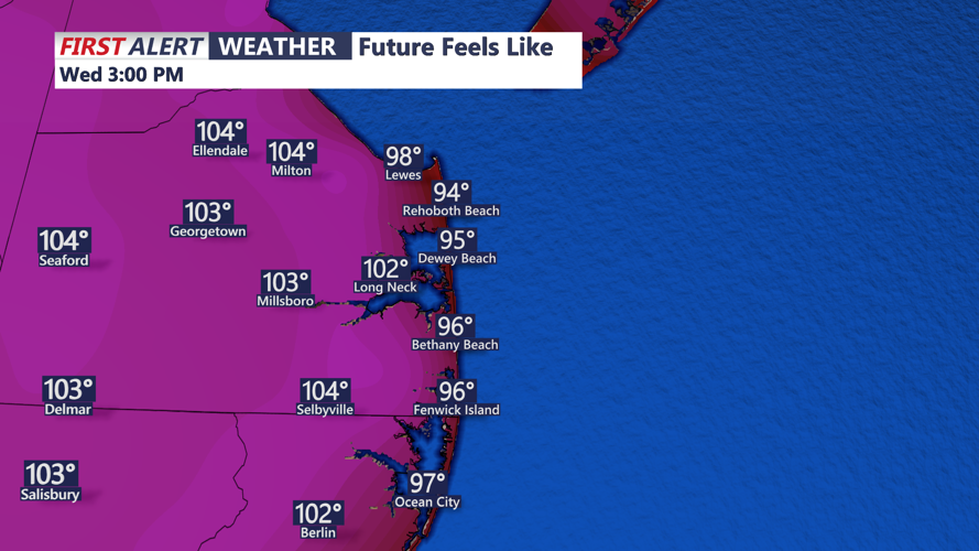
Looking ahead to Tuesday and Wednesday, conditions will stay hot and humid, with highs in the mid to upper 90s and heat index values potentially exceeding 105 degrees. Some form of heat advisory may be issued as dangerous heat and humidity persist.

It will feel like 100 to 105 Monday and Tuesday, Wednesday feeling 105-110.
By late Wednesday night into Thursday, a strong cold front is forecast to move across the region, bringing the next chance for widespread showers and thunderstorms. While the timing of the front may limit severe weather potential, storms could still produce heavy rain, with flash flooding possible due to high moisture levels.
By Friday, any lingering showers should clear, giving way to strong high pressure for next weekend. Cooler and drier air will settle over Delmarva, with temperatures falling as much as 5 to 10 degrees below normal for early August.
