


DELMARVA - Sussex County and nearby beach towns from Lewes and Rehoboth Beach south through Bethany Beach, Fenwick Island and Ocean City, Maryland, face a dangerous stretch of weather from late Monday evening into late Tuesday evening as a powerful cold front sweeps through the region.
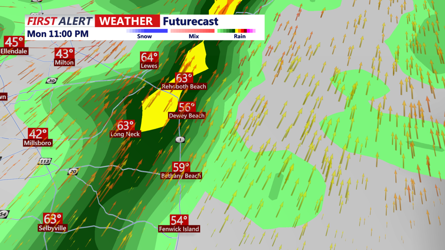
The main threat Monday evening will be strong to severe thunderstorms developing along and ahead of the front. Damaging winds are the primary concern, but an isolated tornado cannot be ruled out, especially in fast-moving line segments. Heavy downpours may also lead to localized flash flooding, mainly in poor-drainage and inland areas.
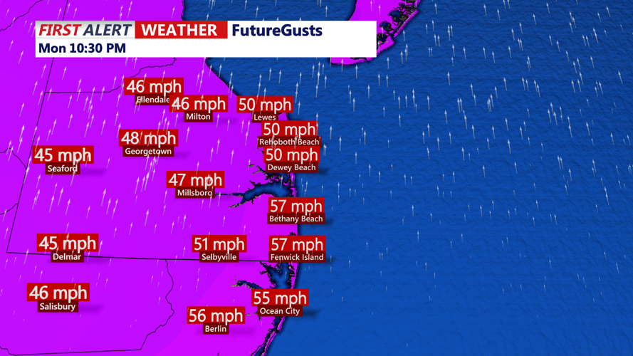
Outside of thunderstorms, strong southerly winds are expected to remain a major hazard, especially near the coast. Gusts of 45 to 55 mph are possible Monday evening and overnight, with the strongest winds likely in exposed coastal communities and along the beaches. A Wind Advisory has been expanded inland to cover the entire area, while marine conditions remain especially dangerous with a Gale Warning continuing until 6 a.m. Tuesday.
Along the Sussex County coast, we are also watching for minor coastal flooding in vulnerable back-bay locations, particularly around Rehoboth Bay and Little Assawoman Bay. Those areas are prone to flooding during strong southerly wind events because water cannot drain efficiently during low tide. That means impacts may continue outside the usual high-tide cycle, with some water covering roads, marsh edges and low-lying properties near the bays Monday evening into early Tuesday.
Conditions are expected to change sharply after the cold front moves through. By Tuesday, showers and storms will have ended, but strong west to northwest winds will continue through much of the day, with gusts up to 40 mph keeping travel difficult for high-profile vehicles and making beach and marine conditions hazardous. The air will also turn much colder, ending the brief stretch of warm, humid weather.
By late Tuesday evening, Sussex County and the resort towns down to Ocean City should be dry, cooler and turning quieter, though breezy conditions may linger. The colder, drier air is expected to hold through midweek before temperatures begin to moderate later in the week.
