


DELMARVA -- The peninsula remains locked in dangerous heat and humidity as high pressure slowly shifts offshore today.

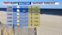
Mostly sunny, hot and humid feeling like 103-108.
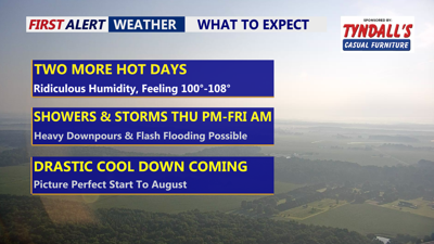
Afternoon highs along the coast are forecast to reach the upper 80s to low 90s, but oppressive humidity will drive heat index values into the 103–108 degree range.

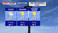
Highs in the mid to upper 80s to low 90s at the coasts, mid 90s inland and Eastern Shore.
A modest southwesterly breeze will keep the air thick and uncomfortable, with little relief expected overnight. Temperatures tonight will only dip into the low to mid-70s under partly to mostly cloudy skies ahead of an approaching cold front.
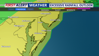
On Thursday, the slow-moving front will push through the region, sparking widespread showers and thunderstorms. A heightened risk of flash flooding, especially Thursday afternoon and evening, as heavy rainfall could produce 1 to 2 inches of rain with localized totals exceeding 3 inches. A few isolated severe storms that could produce damaging winds are also possible especially across the west and northern portions of the peninsula.

Storms late Thursday could produce some localized flash flooding concerns.
By Friday, the front is expected to settle to the south of the region, while a weak coastal low develops and Canadian high pressure begins building in from the north. This will bring much cooler air, breezy northeast winds of 10 to 20 mph — with gusts near 30 mph — and lingering showers and drizzle. Highs on Friday will only reach the mid to upper-70s to near 80.

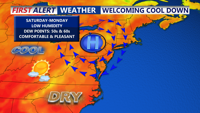
Canadian high pressure will bring a drastic temperature drop into the weekend.
The good news for Delmarva comes this weekend as high pressure takes full control. Drier, more comfortable air will sweep into the region Saturday, sending dew points into the 50s and even upper 40s in some areas. Afternoon highs will rebound to near 80 degrees Saturday and into the low to mid-80s Sunday through Tuesday, with clear skies and pleasant humidity levels. Overnight lows will cool into the 50s and 60s, making for one of the nicest stretches of mid-summer weather so far this year.