


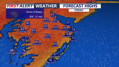
DELMARVA -- Summer-like warmth takes hold across Delmarva today as breezy southwest winds continue across the peninsula. Inland communities will climb into the low 80s, while coastal spots remain cooler with highs in the upper 60s to low and mid 70s.

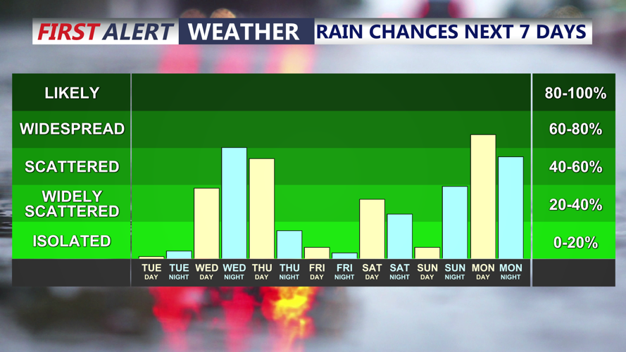
Scattered showers Wednesday-Thursday, isolated shower Saturday, then another chance of rain early next week.
Winds will increase by late morning and remain gusty through the afternoon, generally sustained at 15 to 20 mph with gusts reaching 25 to 35 mph. Combined with relative humidity dropping into the 25 to 35 percent range during peak heating, there will be an elevated fire concern across Delmarva today. While dew points are expected to be a bit higher than Monday, the combination of dry air, warm temperatures and gusty winds will still allow fuels to dry out.
Tonight will stay mild and breezy with partly to mostly cloudy skies. Lows will settle in the upper 50s to low 60s.
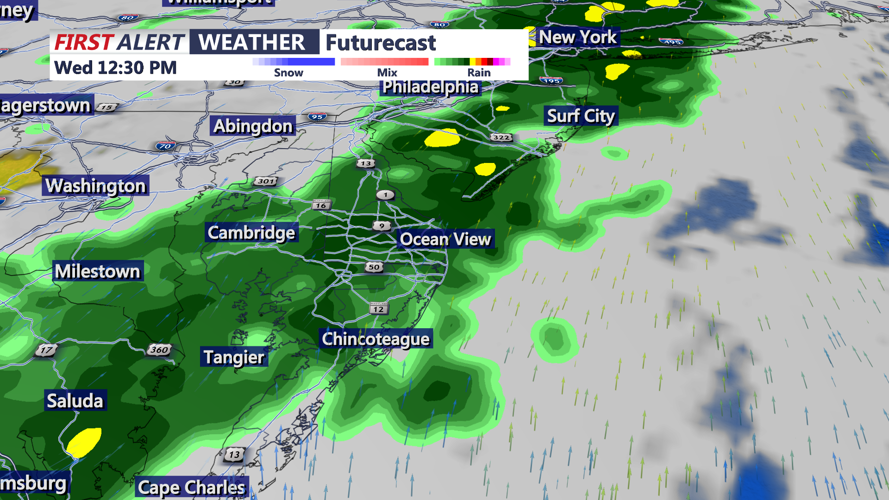
Clouds increase Wednesday as a cold front approaches from the northwest. Scattered showers will begin moving into Delmarva late Wednesday morning, with the steadiest rain expected during the middle of the day and into the afternoon. Highs Wednesday will reach the mid 70s.

Scattered showers Wednesday afternoon-evening, front stalls over the area into Thursday.
That front is expected to slow down and stall near or just east of the region. A second area of low pressure developing over the Southeast will then lift toward the Mid-Atlantic coast along the stalled boundary Wednesday into Thursday. Recent trends keep this system a bit farther south and east, which could place southern Delmarva, including Worcester, Somerset and Accomack Counties, in line for the highest rainfall totals.

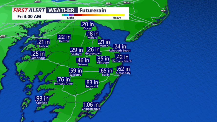
Rainfall totals Wed-Thu on the order of 0.20" to 0.50" heaviest totals over over a half an inch to the south.
Most of Delmarva will likely receive around a half inch of rain, with up to an inch possible in a few southern areas. Crisfield and Chincoteague have the best chance of seeing totals near one inch, but this will not be enough to end the ongoing dry stretch. Still, the rain will be beneficial.
Severe weather and flooding are not expected to be major concerns. Instability looks low, and while an isolated thunderstorm is possible, the overall setup favors showers rather than strong storms.
Friday looks beautiful across Delmarva with mostly sunny skies and highs in the mid to upper 60s.
A weak system may bring a few showers back to the peninsula on Saturday. At this point, it appears to be more of a weekend nuisance than a significant weather maker. Saturday will be partly cloudy with highs in the low 70s.
Mother’s Day is shaping up nicely with mostly sunny skies and highs near 80 degrees. Another chance for showers may arrive early next week.
