



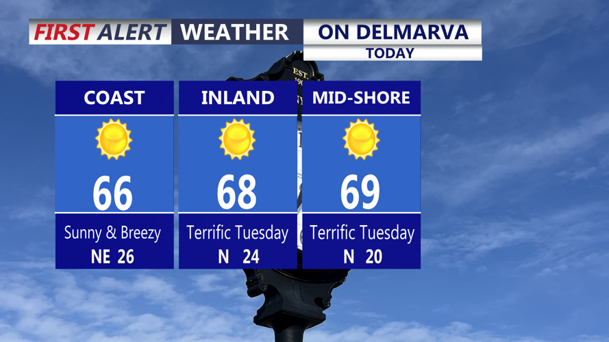
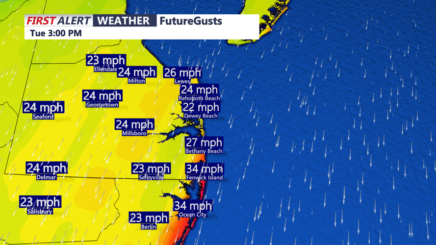

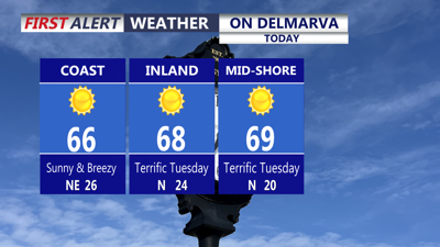
DELMARVA -- A terrific Tuesday on the peninsula, aside from the nor'easter spinning hundreds of miles offshore that will continue bringing minor impacts to the coast over the next few days. Highs today under wall-to-wall sunshine mid to upper 60s, some 70s possible inland, at the coast mid 60s. Winds will continue to gust 25 to 30 inland, at the beaches gusts to 35 mph out of the north northeast.

Onshore winds will gust 25 to 30 inland, 35mph+ at the coast through Wednesday.
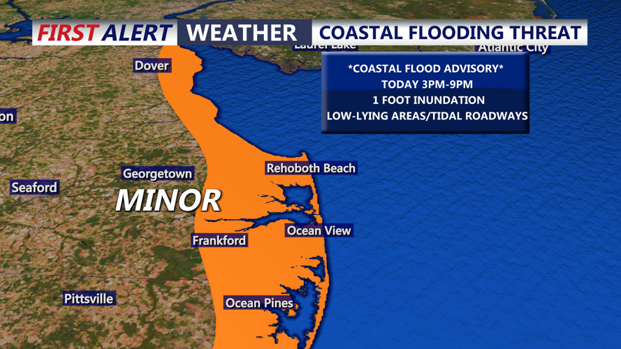
Coastal Flood Advisories are up for the entire Delmarva coast through Wednesday. MINOR tidal flooding through this evenings high tide cycle, up to a foot of inundation in low-lying area and along the shoreline.

MINOR coastal flooding is possible through this evenings high tide cycle.
Tonight starry skies, falling into the upper 40s to low 50s, winds will gust 25 to 35 mph at the coast.
The nor'easter which may become subtropical storm Josephine in the days ahead will remain well offshore. Some clouds may stream into the coast Wednesday, otherwise it's a mostly sunny day with highs around the upper 50s to low 60s. Winds will gust to 35 mph. Coastal flooding concerns will persist through Thursday, as well as dangerous surf and beach erosion.
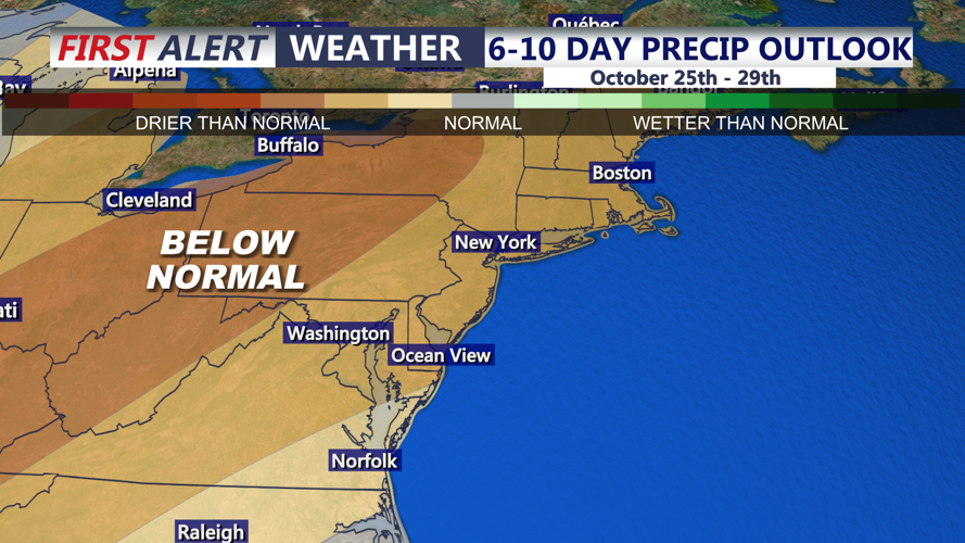
Sunny dry weather conditions will remain, Thursday mostly sunny skies highs back in the upper 60s. By Friday highs in the upper 50s to low 60s with high pressure building into the east. Sunny skies will continue into the weekend with highs in the low to mid 60s. Frost is possible by Sunday morning as areas away from the beaches fall into the 30s. Temperatures will push back into the low 70s early next week. Overall the pattern looks very dry as we round out the month of October.

Dry weather pattern as we round out the month of October.
