


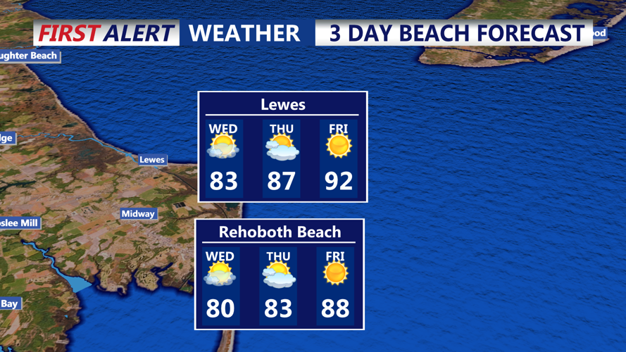

DELMARVA - Delaware’s beach towns can expect a stretch of favorable summer weather through Thursday, thanks to a persistent area of high pressure.
Late Tuesday into Wednesday night, conditions will remain mostly clear with just a few sea breeze-driven showers or isolated thunderstorms early in the evening. These will taper off quickly after sunset. Overnight lows will fall into the mid-60s to low 70s, and patchy fog may form late at night as winds calm and temperatures approach the dew point.
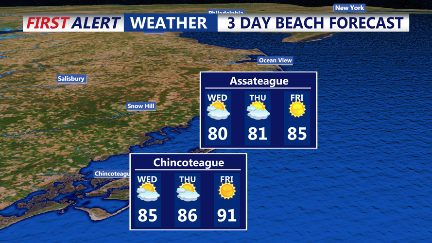
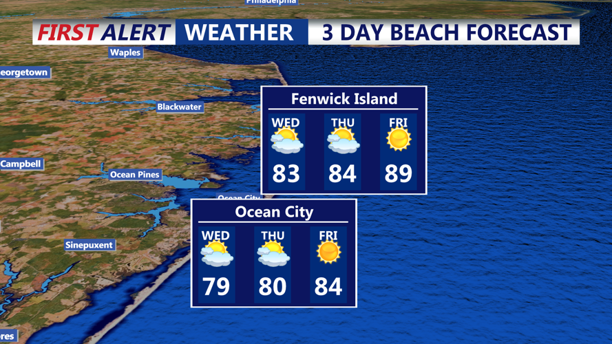
By Wednesday and Thursday, high pressure continues to dominate, shifting offshore and bringing in a gentle southwest breeze. Skies will stay mostly sunny, and humidity will gradually build. Highs both days are expected to climb into the mid to upper 80s along the coast—ideal for beachgoers looking for sun and sand.
Evenings will be mild with clear skies and lows in the upper 60s to low 70s. Humidity levels will be creeping upward by Thursday night, setting the stage for hotter and more humid weather by Friday.
Looking Ahead:
A strong return flow on Friday will usher in rising dew points and heat index values possibly reaching 100 to 105 degrees inland, with slightly lower values along the immediate coast. A cold front will approach from the north by late Friday, bringing the potential for scattered showers and thunderstorms into the evening. While it’s too early to determine the severity, a few strong storms cannot be ruled out.