



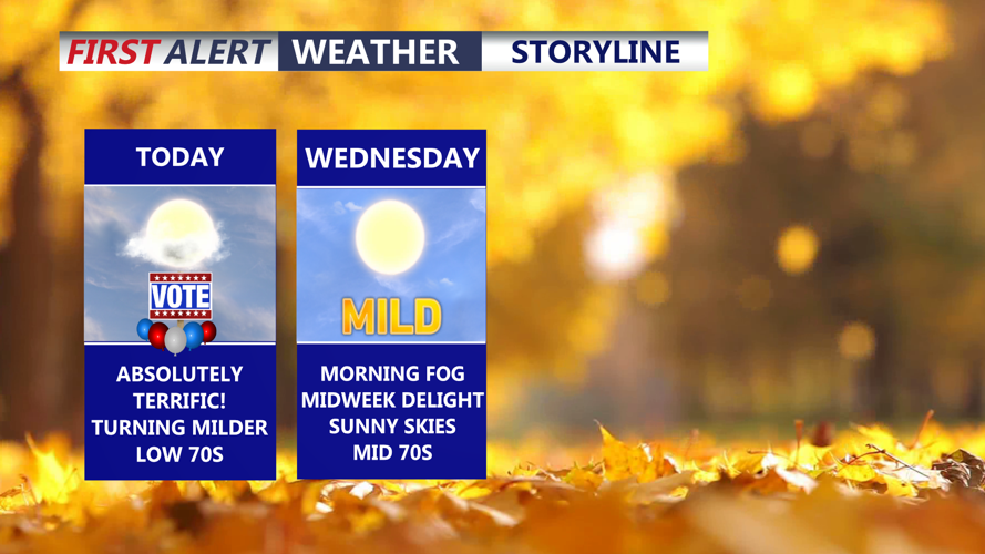
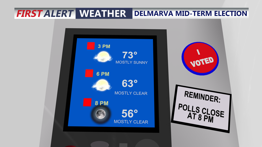

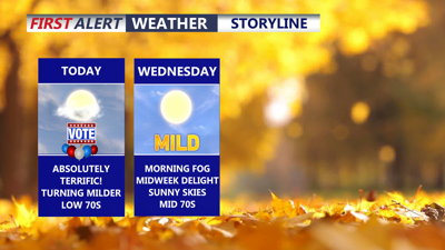
DELMARVA -- Enjoying a beautiful Election Day on the peninsula, mostly sunny skies and temperatures rising into the low to mid 70s inland to mid to upper 60s at the coast. Winds out of the south 5 to 10 mph.

Temperatures will rise into the low 70s under mostly sunny skies.
Tonight expect some areas of fog to develop as dew points continue to rise, will remain clear and winds will stay calm with lows in the upper 40s to low 50s.

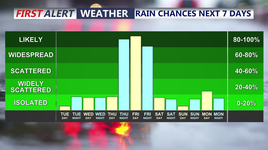
Rain chances increasing late week, a cold front will bring the threat of heavy rain Friday.
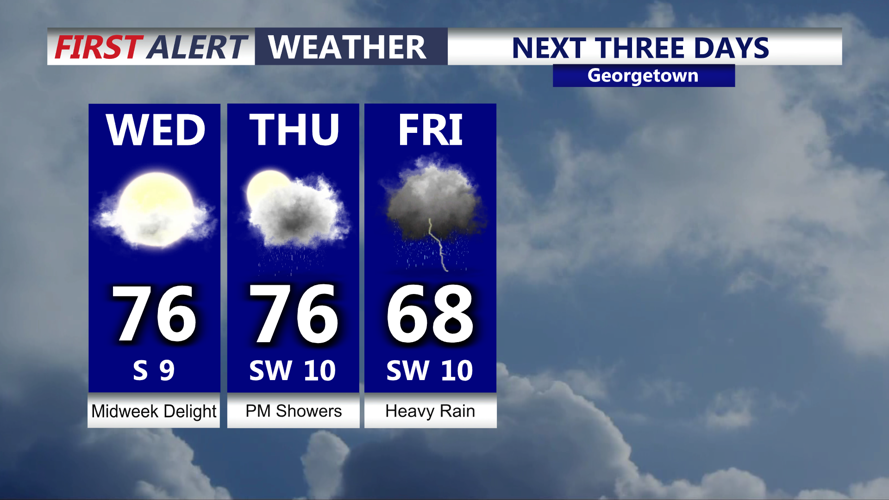
Wednesday will be a midweek delight highs in the mid 70s, with mostly sunny skies and temperatures will be running about 10 to 15 degrees above normal. Thursday clouds will increase it will remain mild in the mid to upper 70s, showers will develop late in the day through the night as an approaching storm system will bring late week rain.

Mild and dry conditions persist, rain moves in late Thursday, heavy at times into Friday.
An area of low pressure will pass to our northwest and spread a cold front into the region Friday. The front will stall out over the region Friday. Still uncertainty in to how quickly the front will push through that will depend on the amount of rainfall we see. Models have increased in rainfall for Friday. Some heavy rain and embedded thunderstorms are possible Friday morning through Friday afternoon. Possible we see one to two inches of rain with locally higher amounts. The front will push east Saturday, however some models keep some clouds in place.
Temperatures Saturday will be in the upper 60s to near 70, the cooler air will be delayed to arrive. By Sunday expect partly cloudy skies and highs in the low 60s. Will settle into a cooler dry weather pattern next week as high pressure builds in, highs in the upper 50s to low 60s.
