


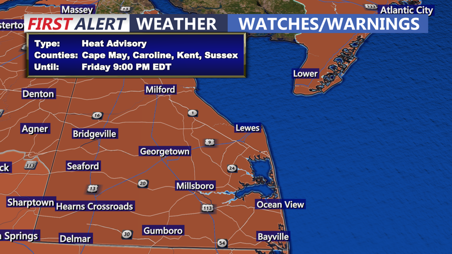


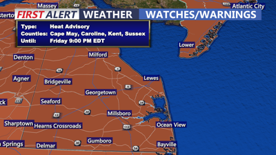
DELMARVA -- It’s back to reality on Delmarva as sweltering heat and humidity returned Friday, prompting a Heat Advisory for the entire peninsula.

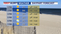
Mostly sunny hot and humid with highs in the mid to upper 90s, could see an isolated t-storm this evening.
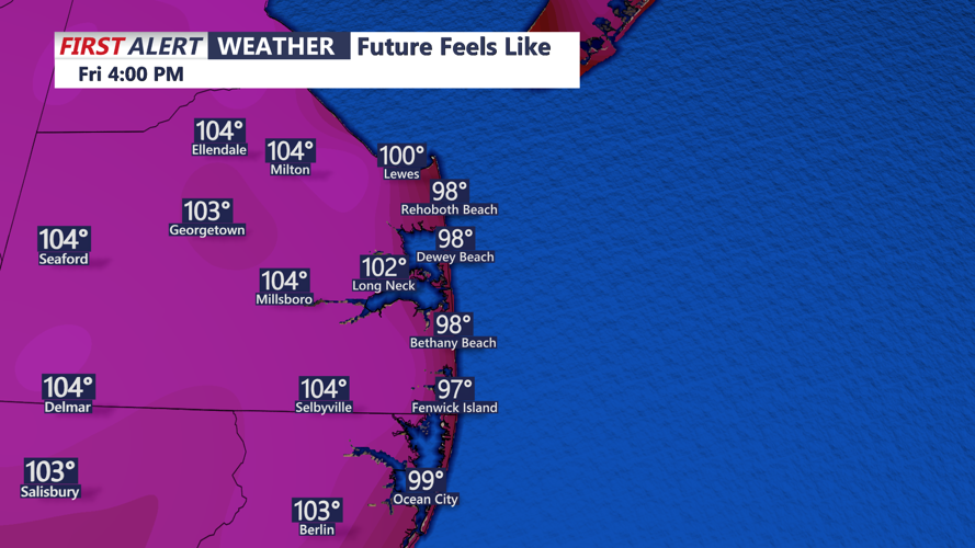
Heat indices were expected to climb between 103 and 110 degrees under the influence of a high-pressure system stationed southeast of the region.

Heat indices Friday afternoon will range from 103 to 110 on Delmarva.
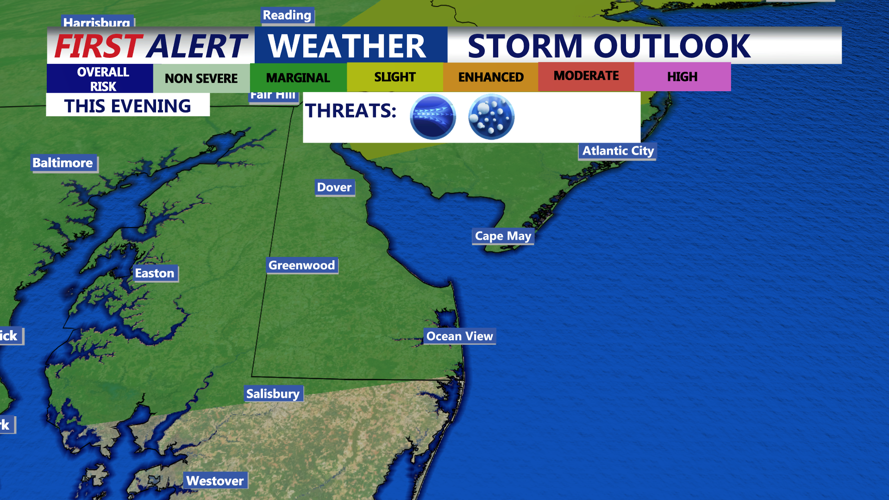
A cold front will move through late Friday night, bringing the chance of isolated thunderstorms. While the Storm Prediction Center placed all of Delaware and parts of the Eastern Shore under a marginal risk for severe storms, the main severe threat lies farther north along the Interstate 95 corridor. Any storms that reach Delmarva are expected to weaken by evening.

Storm Prediction Center has a "Marginal" risk of an isolated severe storm this evening, primarily from Sussex County, Eastern Shore on northward.
Saturday’s weather will offer slight relief as high pressure slides north, but conditions will remain warm and humid. Highs will reach the 80s with onshore breezes and heat indices near 100 across the southern portion of the Eastern Shore. Only a 20% to 30% chance of late-day showers or storms exists, with most of the day staying dry.

Humid weekend ahead, isolated storm chance Saturday, scattered chance Sunday. Not a washout by any means.
Sunday appears more unsettled as another disturbance moves through, bringing a greater chance of showers and thunderstorms and the potential for localized flash flooding. Cloudier skies are expected to hold temperatures down, but the atmosphere will remain saturated with high humidity levels. Highs in the upper 80s to near 90.
Looking ahead, high pressure is forecast to build Monday, providing the driest day of the week, but hot and humid weather will quickly return by midweek with another cold front approaching. Temperatures through Wednesday will run 5 to 10 degrees above normal before cooler, drier conditions arrive late next week into the start of August.


