


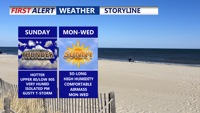


DELMARVA -- The peninsula will bake under steamy conditions Sunday as a cold front approaches from the northwest, bringing the potential for isolated late-day thunderstorms.

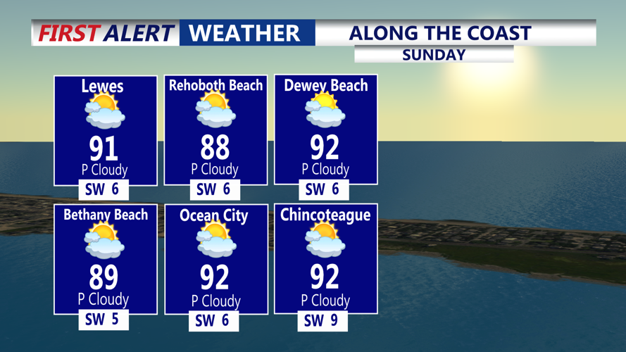
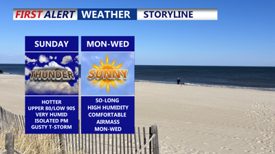
Highs tomorrow in the upper 80s to low 90s, feeling like 100 to 103, PM gusty storms possible.
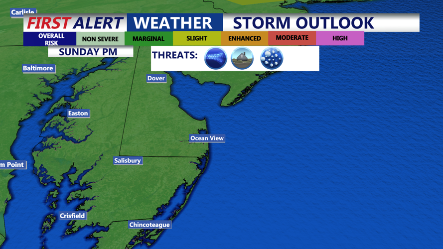
Temperatures are expected to reach the upper 80s to low 90s by the afternoon, with dew points in the low to mid 70s, sending heat index values soaring to between 100 and 104 degrees. The Storm Prediction Center has placed the region under a “Marginal Risk” (Level 1 of 5) for severe weather, including damaging wind gusts, hail, and localized flash flooding.

Storm Prediction Center has a "Marginal" (1 of 5) risk for severe storms Sunday afternoon-evening. Isolated storms could bring damaging winds and hail.
A mid-level shortwave disturbance moving rapidly east from the Ohio Valley overnight is expected to limit storm development for much of the day. Filtered sunshine and strong surface heating may allow a few late-day storms to form as the cold front sweeps through the region.
While widespread flooding is not anticipated, any stronger storms could produce heavy rainfall in short bursts, leading to localized flash flooding, particularly in poor-drainage areas.
By Sunday evening, any remaining storms will begin to taper off, with gusty winds diminishing after sunset.
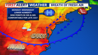
Following the frontal passage, much drier and more pleasant conditions will set in across the region through Tuesday. Dew points will drop into the 50s and lower 60s, and daily highs will remain in the 80s. A broad area of high pressure and upper-level ridging will dominate the weather pattern, leading to dry and mostly sunny skies.

Cold front will usher in lower humidity and cooler temperatures Monday through Wednesday.
The reprieve from the humidity will be short-lived. By Thursday, southerly winds will bring back higher humidity levels and rising temperatures. Friday is shaping up to be the muggiest day, with heat index values once again climbing above 100 degrees across much of Delmarva.
A new cold front is expected to approach by the weekend, potentially bringing another round of showers and thunderstorms. However, the timing and intensity of any storms remain uncertain at this point.