


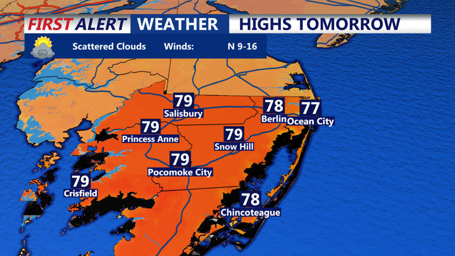

DELMARVA - An upper-level low will develop over the area on Tuesday, which complicates our forecast. Guidance has trended notably upward in shower coverage for Tuesday, aided by forcing and upper-level cold pool-induced instability from the nearby upper low. As a result, temperatures have been adjusted downward, while cloud cover and precipitation chances have been increased, with the best coverage likely in the afternoon north of Delmarva. Despite this, we are not expecting a washout—just an increased chance of showers compared to the previous forecast 24 hours ago. Highs will mostly be in the 70s.
The loss of heating should allow any showers to dwindle quickly Tuesday evening, with clouds mostly scattering out. This will allow temperatures to drop into the 50s to low 60s for most of the region.
The upper low pulls to the northeast on Wednesday, but a trailing shortwave will cross the region. While this should mostly result in a dry day, the lingering upper cold pool and trough forcing will likely elevate cloud cover to a bit above mostly sunny by midday and during the afternoon. Otherwise, a notable warming trend will be underway, with highs returning to the 80s for most.