


DELMARVA - Sussex County residents can expect a soggy and breezy start to the weekend as an upper-level system and accompanying surface low move through the region beginning Thursday evening.
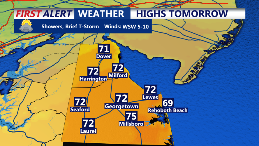
By late Thursday, showers are expected to develop as a stalled boundary across the area interacts with strengthening upper-level lift. Rain will become more widespread overnight, transitioning from scattered thunderstorms to a more steady, stratiform rainfall. Some rumbles of thunder are possible, but severe weather is not anticipated. Rainfall amounts will generally remain under an inch, helping to ease dry conditions without posing a significant flood risk.
Friday will bring more persistent showers and overcast skies as the surface low slowly moves north along the New Jersey coast. A weak onshore flow will contribute to a raw, damp feel, with high temperatures hovering in the 60s. Rain should begin to taper off Friday night as drier air filters in from the west.
Conditions improve on Saturday as high pressure builds in from the Ohio Valley. A westerly breeze, occasionally gusting up to 30 mph, will help dry the area, though the wind will gradually diminish late in the day. Skies will begin to clear, setting up a brighter and warmer Sunday with plenty of sunshine and highs nearing the 70s inland, though sea breezes may keep coastal areas cooler.
The calm weather is expected to hold through Monday, before another low-pressure system approaches from the southwest midweek, bringing another round of showers to the region by Wednesday or Thursday.
