


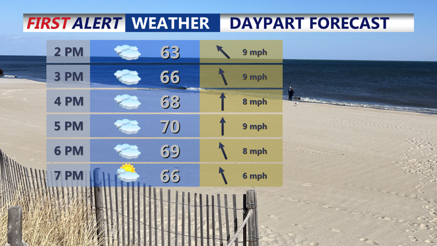


DELMARVA -- Saturday afternoon kicks off a mild and mostly cloudy weekend across Delmarva, with highs ranging from the low to mid 70s. Coastal communities will remain cooler in the 60s and 70s. Increasing humidity Saturday evening may lead to patchy fog development along the coast and nearby waters.
On Sunday, an upper-level trough pushing south from eastern Canada will usher in an evolving weather pattern. A warm front is expected to lift north in the morning, briefly bringing warmer and more humid air. However, a trailing cold front will advance into the region by evening, sparking the development of scattered showers and the potential for isolated thunderstorms. The timing of these features will determine how warm inland areas become, with dew points climbing through the 50s in areas briefly in the warm sector. Fog may again impact marine zones before shifting winds from the southwest to west clear it out. Highs are expected to be in the upper 70s to near 80 degrees away from the coast. 60s and 70s at the coast.
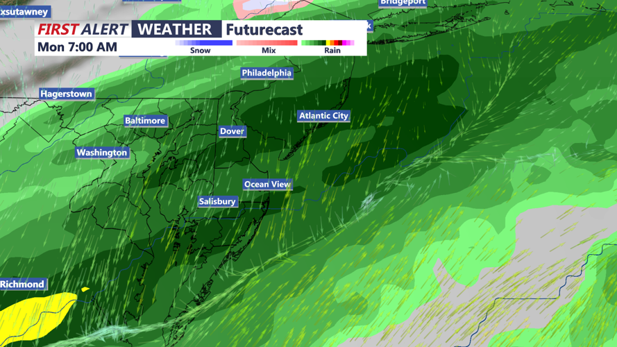
A stronger cold front arrives Monday night, tied to a reinforcing upper-level trough. Precipitation chances remain low, but a few light showers could occur as the front pushes through. Temperatures will fall several degrees below average, and highs Monday may struggle to climb out of the 50s in some areas.
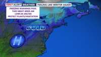
By Tuesday, a gusty wind from the west will usher in even colder air. Highs are forecast to remain in the 50s to possibly just the 40s across much of Delmarva, and overnight lows may dip below freezing. Although breezy conditions could limit frost formation, a freeze warning is possible in regions where the growing season has begun.
Wednesday remains chilly but dry as high pressure builds in. A clear sky and calm winds could allow for frost or freeze conditions overnight.
By Thursday, temperatures begin to recover as southerly flow develops ahead of the next weather system. While most of the day is expected to stay dry, clouds may increase late in the day as a warm front approaches from the southwest.