


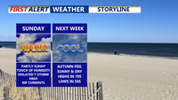
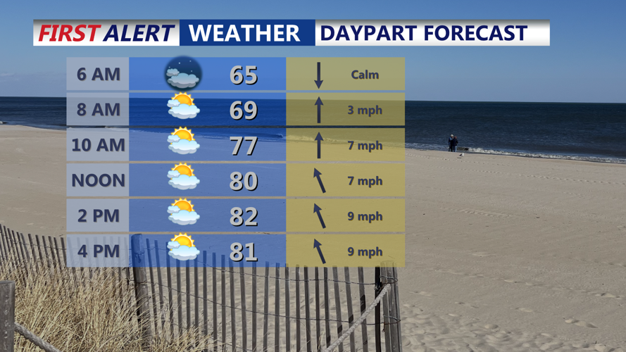

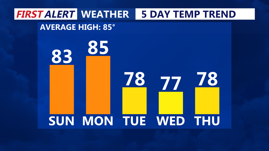

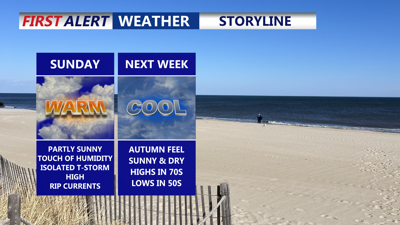
DELMARVA -- Seasonably warm and humid conditions will settle over Delmarva on Sunday, with highs climbing into the low to mid-80s under partly cloudy skies.

Partly sunny skies, warm with highs in the low to mid 80s.
While most of the day will remain dry, a slim chance for an isolated shower or thunderstorm late Sunday evening.

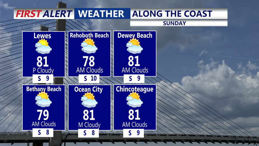
Highs on the coast upper 70s to low 80s, HIGH rip current risk continues.
Along the coast, the main concern will be the water. A high rip current risk continues Sunday for beaches across Delmarva, with waves of 3 to 5 feet driven by distant Hurricane Erin. The risk is expected to ease to moderate on Monday as seas slowly calm. Beachgoers are urged to use caution and follow lifeguard guidance.

Mild the next two days, then highs drop into the mid to upper 70s mid to late week.
Sunday night into Monday morning, lows will settle in the 60s as surface high pressure shifts offshore. This change will allow a cold front to track through the Mid-Atlantic, followed by another weaker front expected Tuesday or Wednesday.
Despite the frontal passage, Monday will still see highs in the low 80s before a much cooler and drier air mass arrives by Monday night. Overnight lows will fall into the mid-50s to low 60s, marking the beginning of a more autumn-like stretch.
Tuesday will bring dry conditions, with dewpoints in the 50s and highs in the 70s. Overnight lows will continue to dip into the 50s, offering crisp mornings across the region.
Looking ahead, expect conditions to stay largely dry through the rest of the week. With dewpoints likely holding in the 50s, Delmarva will enjoy a refreshing taste of September weather just in time to round out August and head into Labor Day weekend.