


DELMARVA -- Saturday will bring a warm and humid start to the weekend across Delmarva, but most areas are expected to stay dry. A stalled frontal boundary will linger near the region as high pressure builds to the north, allowing for partly cloudy skies.

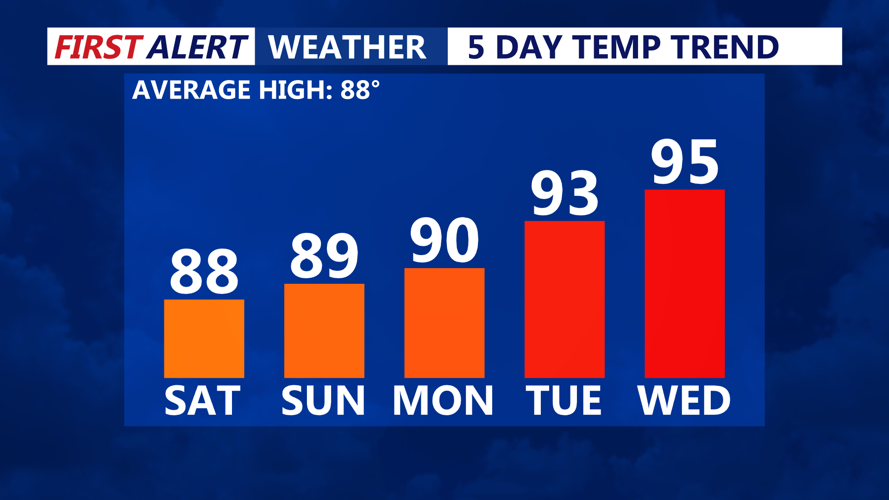
Temperatures upper 80s over the weekend to near 90, low 90s early next week.
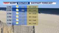
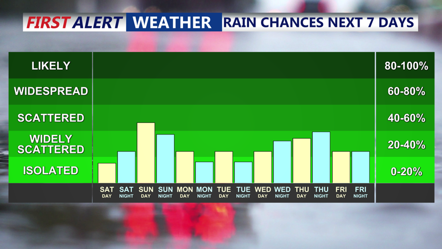
Highs on Saturday are forecast to reach the mid to upper 80s, with heat indices approaching 100 degrees in parts of the Eastern Shore. Only a 20% to 30% chance of showers or thunderstorms is expected late in the day as a disturbance approaches from the west. Where we do see storms, they could turn gusty, isolated severe storm can't completely be ruled out.

Isolated storm Saturday, scattered storms Sunday, then better chance midweek.
Saturday night brings another round of scattered showers and storms particularly overnight into the early morning hours Sunday.
Sunday looks to be the wetter of the two weekend days. Morning showers and storms may linger before a second wave of showers and thunderstorms develops in the afternoon along the front. Limited sunshine is expected, which should keep temperatures slightly cooler, but high humidity and moisture-rich air could produce heavy rainfall. Some localized flash flooding as storms move through can't be ruled out.
Looking ahead, Monday is expected to be the driest day of the week as high pressure returns. Heat and humidity will gradually build again through midweek, with afternoon showers and thunderstorms likely before another cold front moves through Wednesday night, ushering in cooler, drier conditions for late week.