


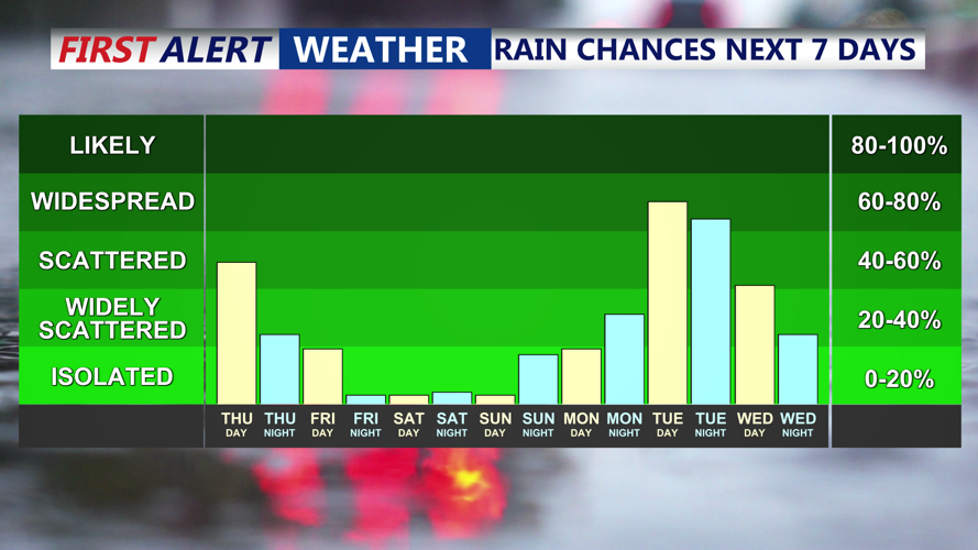

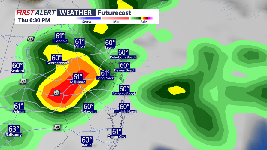


DELMARVA- The unsettled conditions continue today with lots of clouds, drizzle and light rain. A new coastal low is off the Mid-Atlantic coast and tracking northeast into New England, continuing the threat of scattered showers and a few thunderstorms this afternoon. Low pressure responsible for recent wet conditions will continue drifting toward New England Thursday night, with lingering showers and possibly an isolated evening thunderstorm. While rain chances should gradually diminish, low clouds and areas of fog are expected to develop overnight due to lingering moisture and light northwest winds. Overnight temperatures will dip into the low to mid 50s.

Brief downpour and a rumble of thunder possible through Thursday evening.
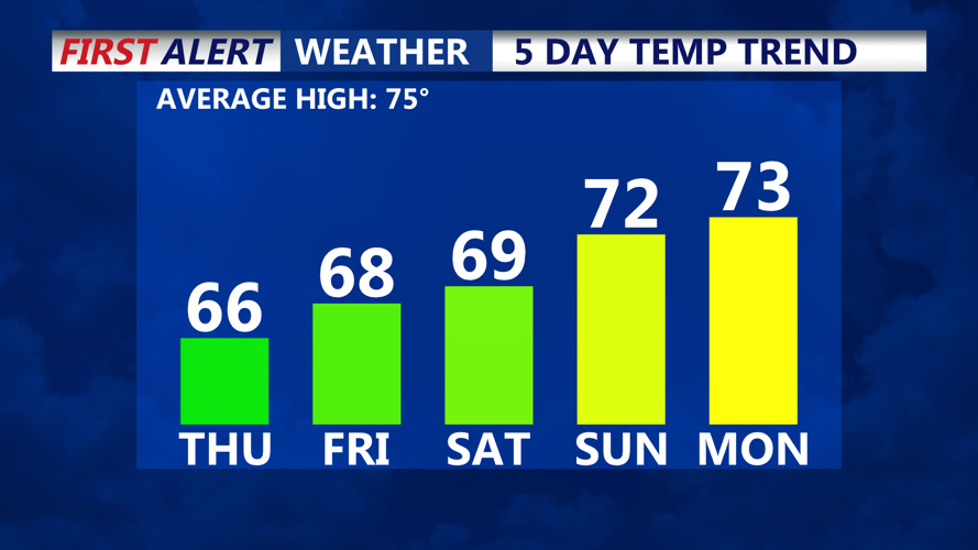
A few lingering showers into Friday. Highs will only be in the 60s the rest of the week, with chilly 50s at night. Friday brings another chance for light rain, especially in the afternoon, as upper-level disturbances continue rotating around the departing low. Although widespread rainfall is not expected, clouds may linger, and gusty winds up to 25 mph are possible in areas that experience breaks in the cloud cover.

Slowly rising temperatures into Memorial Day Weekend, still below average.
Conditions begin to improve Saturday night into Sunday as high pressure briefly builds over the region, ushering in dry and calmer weather for the second half of the holiday weekend.
A drying trend starts just in time for the Memorial holiday weekend. At this point it looks dry and pleasant Saturday through Memorial Day Monday. High temperatures will run below average with highs in the 60s and 70s, with lows in the 50s.


