


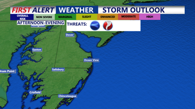
DELMARVA -- A cold front is moving into Delmarva Thursday, bringing the threat of isolated severe storms and a noticeable shift in the weather heading into the weekend.

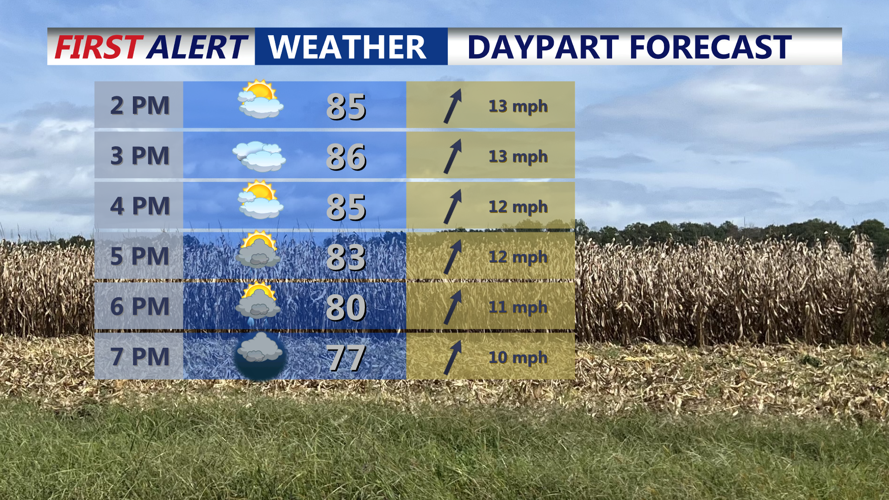
Partly sunny skies, warm and humid highs in the mid to upper 80s, isolated t-storms develop after 5PM, some storms could turn severe.
We have issued a Yellow Alert Day for the region Thursday afternoon into the evening. Highs will climb into the mid- to upper 80s under partly cloudy skies. Showers and storms are expected to develop from west to east late Thursday afternoon and spread across the peninsula through the evening hours.

Some strong to severe storms are possible through the evening, remain weather aware.
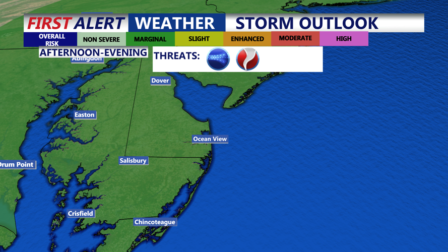
The Storm Prediction Center places the entire Delmarva Peninsula under a marginal risk (1 out of 5) for severe weather. The primary threats include damaging winds of 60 mph or higher and, while unlikely, an isolated brief tornado cannot be ruled out. Residents are urged to stay weather aware between 3 p.m. and 10 p.m.

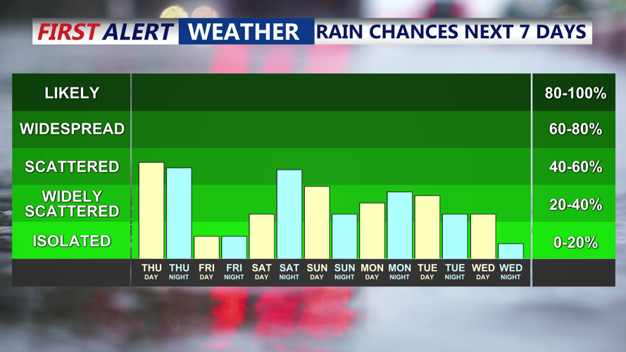
After the rain tonight - early Friday, chance for showers over the weekend, then tropical moisture is possible early next week.
Showers and storms may linger overnight into Friday morning, with lows dipping into the upper 60s to low 70s. Friday will start cloudy and damp, especially across southern Delmarva, before gradually clearing. Highs will reach the upper 70s to low 80s. High pressure will begin to build in from the west, signaling calmer weather ahead.
For the weekend, a weak trough offshore could spark scattered light showers. Rain chances are 20 to 40 percent during the day Saturday, increasing to 45 to 65 percent Saturday night. Highs will settle in the mid-70s with lows in the upper 50s to mid-60s.
Looking ahead, broad high pressure will develop over the central United States early next week, while at least one low-pressure system remains offshore. The National Hurricane Center is monitoring Tropical Storm Humberto and another system Invest 94L which will possibly become Imelda. We caution that steering currents are complicated, which lowers confidence in predicting the exact track of these systems.
Modest rain chances (20 to 40 percent) remain in the forecast from Sunday through Tuesday as temperatures gradually cool into the middle of next week.