


DELMARVA - Expect to stay dry from early Wednesday through early Thursday as high pressure remains the main weather influence across Delmarva.
An upper-level trough near the region will continue to strengthen and shift south Wednesday, with an upper low likely developing near the North Carolina coast. A surface low may form nearby as well, but high pressure is expected to hold firm across Delmarva, Pennsylvania and New Jersey.
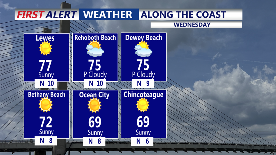
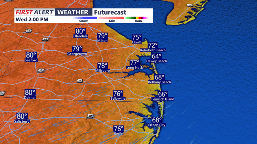
That pattern should keep rain away through Wednesday and Wednesday night. Conditions are expected to remain fair, with seasonably comfortable temperatures early Wednesday before warmer air begins building later in the week.
The dry stretch is forecast to continue into Thursday and through the end of the workweek. Temperatures are expected to trend upward, with inland areas likely reaching the low 90s by Friday and Saturday. Coastal areas should stay cooler, with highs generally in the mid- to upper 80s.
MODERATE rip current risk today for the Delaware Beaches, as well as the Maryland and Virginia Beaches, waves 2 to 3 feet.
A change in the pattern could arrive late in the weekend into early next week, when a trough from the northwest may bring cooler weather and a chance for showers.
