





DELMARVA - The remnants of Hurricane Isaias are expected to bring a wet and windy Sunday afternoon and evening to Sussex County, with periods of heavy rain, gusty winds and a limited threat of severe thunderstorms before conditions improve Monday morning.
According to the latest forecast discussion from the National Weather Service in Mount Holly, New Jersey, widespread rainfall will remain the primary concern as the weakening storm system moves across the Mid-Atlantic region Sunday night into early Monday.
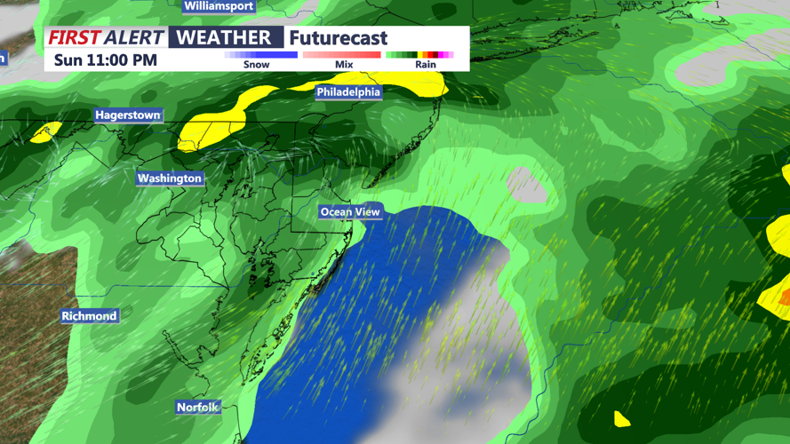
Rainfall totals of 1 to 2 inches are expected across much of the area, with isolated amounts approaching 3 inches where heavier downpours develop. The greatest rainfall intensity is anticipated Sunday afternoon into the evening, increasing the potential for localized flooding along roadways and in poorly drained communities.
The region remains under a marginal risk for excessive rainfall, indicating that isolated instances of flash flooding are possible. However, widespread significant flooding is not currently anticipated.
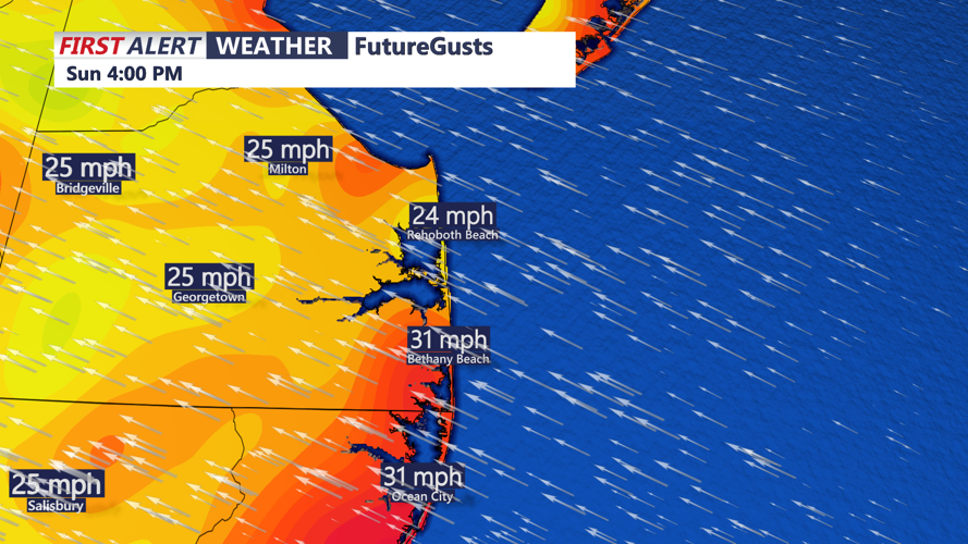
Winds will also strengthen Sunday afternoon, with gusts reaching 30 mph inland and potentially 40 mph along the immediate coast. Communities including Lewes, Rehoboth Beach, Dewey Beach, Bethany Beach and Fenwick Island will experience some of the strongest winds, particularly in exposed waterfront locations.
The severe weather threat has decreased slightly in the latest forecast. Although an isolated strong to severe thunderstorm remains possible late Sunday afternoon or evening, the risk of a brief tornado is now considered very low. A few stronger thunderstorms could still produce locally damaging wind gusts.
Temperatures Sunday afternoon will generally remain in the upper 60s to lower 70s, accompanied by widespread clouds, occasional heavy downpours and periods of reduced visibility.
Along the beaches, marine conditions will remain hazardous. A Small Craft Advisory is in effect for Delaware's Atlantic coastal waters through 6 a.m. Monday, with waves building to 7 to 10 feet Sunday afternoon and evening. The previously issued Gale Watch has been canceled as confidence in widespread gale-force winds has decreased.
Minor tidal flooding also remains possible in vulnerable coastal and back bay communities, although widespread significant coastal flooding is not expected in Sussex County.
Rain should gradually become more scattered late Sunday evening and overnight as the remnants of Isaias move across the region. Some showers and isolated thunderstorms could continue into early Monday morning, particularly across southern Delaware.
By Monday morning, winds will gradually shift toward the north and northwest as the weakening storm system moves northeast of Delmarva. Lingering clouds and scattered showers could affect the morning commute before drier air arrives later in the day.
Monday afternoon is expected to bring improving conditions, with decreasing rain chances, some breaks in the clouds and temperatures approaching 70 degrees.
Residents should remain alert for quickly changing weather conditions Sunday afternoon and evening, particularly when traveling. Motorists should avoid flooded roadways, while coastal residents should secure loose outdoor objects ahead of the strongest wind gusts.
