


DELMARVA - A significant winter storm is just hours away from impacting the peninsula as an area of low pressure moves along the coast later Tuesday, bringing heavy snowfall across the region.
The system, currently organizing in the Deep South, is expected to transfer energy to a secondary low off the North Carolina coast this evening. This secondary system will track off Delmarva’s coastline tonight, producing widespread snowfall across the area.

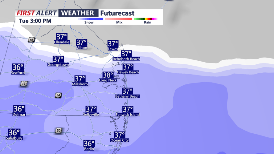
Snow will move in after noon moving in from south to north.
Snow is forecast to begin shortly after noon, progressing northward throughout the afternoon. While initial temperatures may hover around or just above freezing. We anticipate light to moderate snowfall through the afternoon, with heavier bands developing into the evening. Some areas may see enhanced snowfall rates due to a strong atmospheric feature, increasing the potential for locally higher totals.
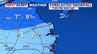
As of this morning, the National Weather Service has maintained a Winter Storm Warning for Delmarva, with expected snow accumulations of 5 to 7 inches. Some locations could receive over 7 inches depending on the placement of heavier snow bands.
Conditions will rapidly deteriorate as the sun sets and the snowfall rates begin to pick up in intensity with snowfall rates of 1 to 2 inches per/HR. Driving this evening is discouraged.

A general 5-7 inches expected, locally up to 9" is possible.
The storm will begin to taper off early Wednesday morning as the system moves away. Overnight low temperatures are expected to dip into the low 20s to low 30s, making for slick and hazardous conditions into the morning commute.
Our one-two punch continues Wednesday afternoon - Thursday as the second system will bring rain to the area as temperatures rise into the 40s. A messy week on the Delmarva peninsula to say the least. Stay with the First Alert Weather team on-air, online, on social media and our radio partners throughout the day.