


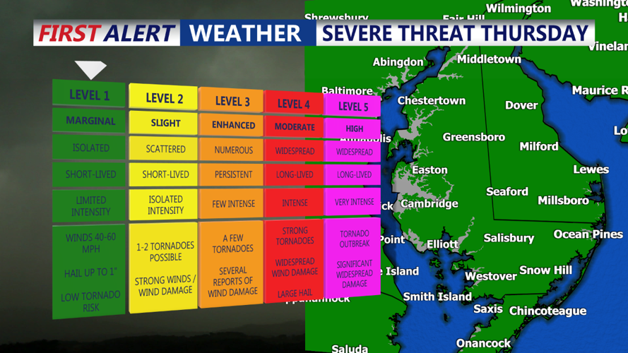


DELMARVA- High pressure will be centered to our south and east through, moving further out to sea tonight. A cold front will approach the area on Thursday and cross through the area by Thursday night. The front will stall to our south on Friday before lifting back north as a warm front on Saturday. Another cold front will move through on Sunday, with a stronger system impacting the area from Monday into Tuesday. High pressure will return on Wednesday.
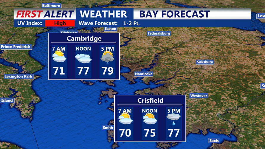
A very warm to hot afternoon is in progress across much of the region, except for coastal locations where a sea breeze is moderating temperatures. This warmth and increased humidity will continue through Thursday.
A closed low centered just north of the Midwest and upper Great Lakes region will gradually shift eastward through Thursday night. Accompanying this system, surface low pressure will travel eastward, bringing an associated cold front that will cross our area Thursday night. Some convection is expected ahead of this cold front, along with a surface trough.