





A beautiful Thursday is ahead across Delmarva with hazy sunshine, highs in the upper 80s to low 90s and a refreshing sea breeze developing at the beaches. A cold front will continue pushing south through Friday, opening the door to cooler and less humid weather for Saturday and the first half of Sunday. Showers and thunderstorms return to the forecast Sunday afternoon into Monday, while spotty minor tidal flooding is possible during Thursday evening’s high tide along portions of the Delaware coast and Delaware Bay.
From
To


A warm front will bring scattered showers and thunderstorms to Delmarva today, with the greatest rain chances across the northern peninsula. Localized heavy rainfall could cause flash flooding. Hotter and increasingly humid conditions will then settle across the region through the weekend, when heat index values may reach or exceed 100 degrees.

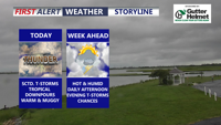
Periods of heavy rain and thunderstorms could cause localized flash flooding across Delmarva today before a brief break Tuesday.


Delmarva will enjoy mostly dry and seasonable weather through Saturday before showers, thunderstorms and a heavy rain threat increase Sunday into Monday.

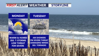
Scattered strong storms are possible across Delmarva today, but Tuesday is expected to bring the greatest threat for severe weather and flash flooding.

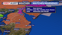
A sunny and increasingly hot Tuesday will lead into dangerous heat Wednesday, followed by a potentially stormy weekend across Delmarva.


Warm, muggy weather continues across Delmarva today as a cold front approaches. Showers and storms are expected this afternoon into the early evening, with damaging winds as the main concern. An isolated tornado and flash flooding cannot be ruled out, especially in southern Delmarva. Quieter, sunnier weather arrives Wednesday and Thursday before heat, humidity, and more storm chances return late this week.

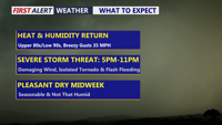
Delmarva faces a hot, humid and windy day with a risk for severe thunderstorms late this afternoon into tonight. Damaging winds, heavy rainfall, flash flooding and an isolated tornado are possible, with the greatest concern between roughly 5 p.m. and 11 p.m. A high rip current risk is also in place from Ocean City to Chincoteague.

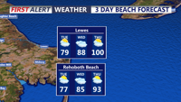
Coastal Sussex County and Ocean City should stay dry from early Tuesday through early Wednesday as temperatures begin to climb.


Delmarva stays sunny, dry and hot today as high pressure keeps control of the forecast. Inland highs climb into the low to mid 90s, while the beaches stay cooler in the mid 80s. Heat and humidity build Saturday before a cold front brings isolated storm chances Sunday, especially across southern Delmarva.