




DELMARVA -- Sunshine and hot temperatures will dominate today as the next surge of summer heat begins building across the peninsula.

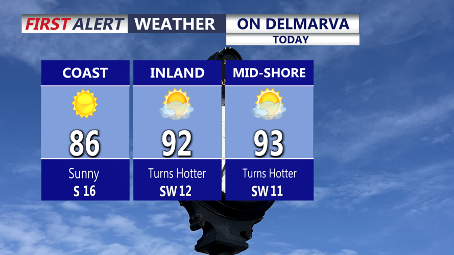
Loads of sunshine today, temperatures getting back into the upper 80s to low 90s, not overly humid.
Humidity will not be excessive early in the day, but southwest winds will gradually draw more moisture into the region. Afternoon highs will reach the upper 80s to lower 90s, with southwest wind gusts approaching 25 mph.

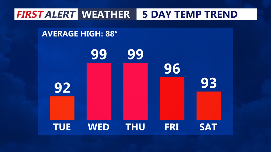
Worst of the heat arrives Wednesday and Thursday as temperatures rise to near 100.
Skies will remain clear Tuesday night, with mild and increasingly humid conditions. Temperatures will fall only into the lower and middle 70s.
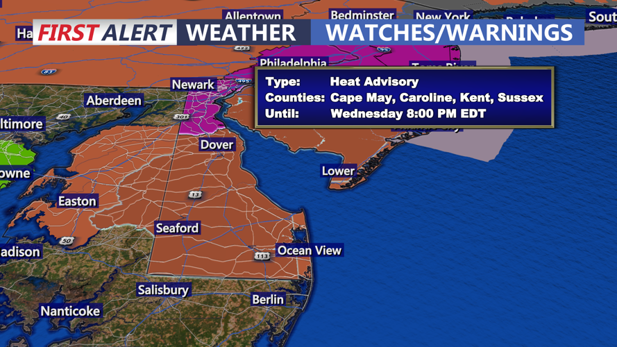
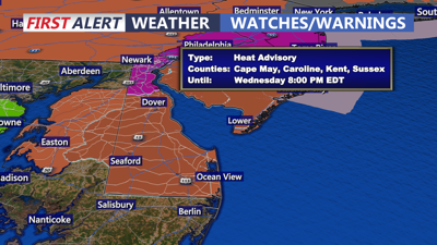
Dangerous heat and humidity will arrive Wednesday as a large area of high pressure expands toward the East Coast. A Heat Advisory will be in effect across much of Delmarva from 10 a.m. until 8 p.m.
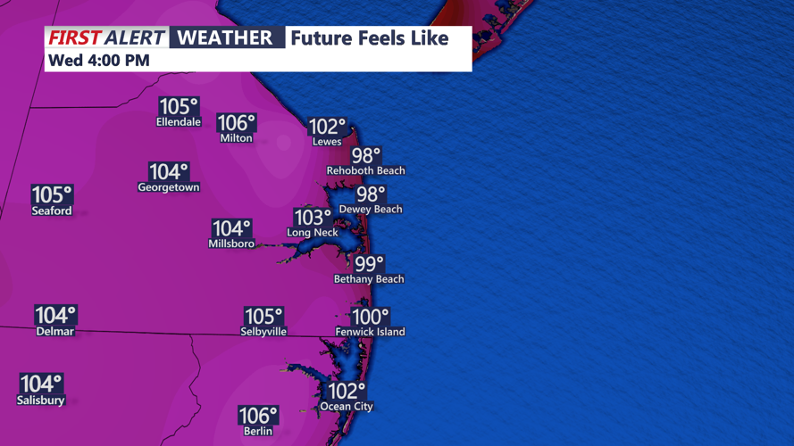
High temperatures will climb into the middle and upper 90s, while increasing humidity will produce heat index values between 100 and 109 degrees across much of the peninsula. Even the Delaware, Maryland and Virginia beaches could experience temperatures in the middle to upper 90s and heat index values near 100 to 105 degrees.

Heat index on Wednesday between 102 to 108 during the afternoon.
A west wind around 10 to 15 mph should prevent the cooler ocean breeze from spreading far inland, limiting relief along the immediate coast. Anyone spending time outdoors should drink plenty of water, take frequent breaks and avoid strenuous activity during the hottest part of the afternoon.
A mostly dry cold front will move through late Wednesday or early Thursday, slightly lowering temperatures and humidity. Thursday will remain hot, however, with highs in the lower to middle 90s and heat index values potentially reaching the lower 100s. An isolated thunderstorm cannot be ruled out, but most of the area should remain dry.
Friday may bring some relief from the humidity as drier air arrives from the north. Temperatures will remain above normal, with highs ranging from the lower or middle 90s.
The weather pattern becomes more active this weekend as another cold front approaches Delmarva. Showers and thunderstorms are possible Saturday and Sunday, with some storms potentially producing damaging wind gusts, frequent lightning and torrential rainfall.
Atmospheric moisture levels are expected to become unusually high, increasing the threat of rainfall rates capable of causing localized flash flooding. The exact timing and severity of the storms remain uncertain and will depend on how much instability develops.
The front could move south of Delmarva by late Sunday, allowing drier weather to arrive Monday. However, the boundary may stall near the peninsula, which would keep showers and thunderstorms in the forecast into early next week.
