



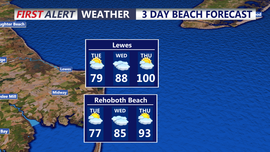
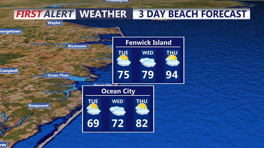

DELMARVA - A quiet stretch of weather is expected from early Tuesday through early Wednesday along the Delaware and Maryland beaches, with high pressure keeping the region mainly dry before heat and storm chances increase later in the week.
Coastal towns from Lewes, Rehoboth Beach and Dewey Beach to Bethany Beach, Fenwick Island and Ocean City, Maryland, should see plenty of sunshine Tuesday. Temperatures will be comfortable along the immediate coast, with highs generally in the upper 60s to lower 70s near the beaches and warmer conditions farther inland.
Winds will turn more southerly Tuesday as high pressure moves offshore. That will begin a warming trend across Delmarva, though the hottest weather will hold off until later in the week.
Tuesday night into early Wednesday should remain mainly dry. Temperatures will not be as cool as Monday night, with lows mostly in the 60s near the coast. Some patchy clouds may develop as humidity slowly increases.
By Wednesday, a warm front is expected to move through the region, bringing more humidity and setting the stage for a more unsettled pattern. While early Wednesday is expected to stay mostly quiet, shower and thunderstorm chances will begin to increase later Wednesday and continue at times through the weekend.
The bigger concern arrives during the second half of the week, when dangerous heat may develop. Temperatures are forecast to climb into the 90s in many areas Thursday, and heat index values could approach or exceed 100 degrees.
We will also monitor storm chances from Wednesday through Sunday. Some storms later in the week could become stronger, though the timing and coverage remain uncertain.
