




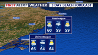
A limited fire weather risk continues into Tuesday evening for inland Sussex County before showers arrive Wednesday with little severe weather threat.
From
To

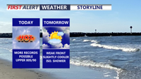
Today marks the third straight day of record-setting heat potential across Delmarva, with highs reaching the upper 80s to around 90 under partly cloudy skies. Dry air, gusty southwest winds, and ongoing drought conditions will also create an elevated fire weather risk. A weak front brings only slight cooling Friday, while a sharper cooldown arrives over the weekend with much-needed rain late Saturday night into Sunday. Early next week turns significantly cooler, with frost or even freeze conditions possible by Monday night into Tuesday morning before temperatures rebound by midweek.

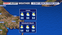
Sussex County could see patchy fog early Friday, followed by mainly dry weather through Saturday morning as a cold front moves through late Friday night.

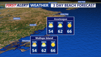
After a blustery Saturday, Sussex County’s beach towns will see improving conditions with milder temperatures Sunday into early Monday. The region remains dry, but don’t forget to set your clocks ahead Saturday night as daylight saving time begins.


Sussex County Prepares for Temperature Swings and High Winds

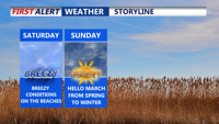
Sussex County residents should prepare for a weather rollercoaster this weekend, starting with mild conditions before a strong cold front sweeps through, bringing gusty winds and a sharp drop in temperatures.

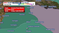
A Coastal Flood Advisory is in place from late Tuesday evening through Wednesday as gusty winds and cold air dominate the region. High pressure will maintain dry and sunny conditions through midweek, but freezing temperatures inland and elevated fire weather risks are concerns.

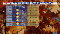
Strong winds and below-normal temperatures will dominate Delmarva on Tuesday, followed by a cold but calmer Tuesday night. Temperatures will dip into the 20s by early Wednesday morning under clear skies.

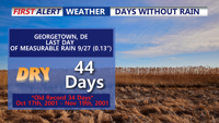
A cold front ushers in cooler, drier air across Delmarva overnight, with gusty winds and chilly temperatures expected through Tuesday. Fire weather concerns persist due to dry conditions and strong breezes.

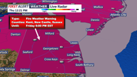
Friday on Delmarva will feature sunny skies and above-normal temperatures, but a Red Flag Warning highlights fire risks due to low humidity and gusty winds; cooler and clear conditions will follow Friday night into early Saturday morning under high pressure.