


DELMARVA - As we move into late Monday evening and early Tuesday morning, Delmarva will feel the effects of a cold front that has already passed offshore. Behind the front, cool and dry high pressure is settling into the region, setting the stage for a crisp and breezy start to the week.
Overnight tonight, temperatures will drop steadily under clear skies, with lows ranging from the upper 30s to mid-40s across the region. A secondary, weaker cold front will pass through early Tuesday morning, but no precipitation is expected due to limited moisture in the atmosphere. Winds will pick up during the overnight hours, shifting to the northwest and becoming gusty by early morning.
Tuesday morning will dawn sunny but brisk, with strong northwesterly winds sustained at 15–20 mph and gusting as high as 30–35 mph by mid-morning. Temperatures will struggle to climb during the day, with highs only reaching the upper 40s in northern areas and the low-to-mid 50s elsewhere across Delmarva. The cold air combined with gusty winds will make it feel even chillier, so dress in layers if you’ll be outdoors.
Fire Weather Concerns:
Tuesday’s gusty winds and very low humidity levels pose an elevated fire weather risk for the entire Delmarva Peninsula. Relative humidity values will drop into the 20–30% range during the afternoon, and the dry conditions combined with the breezy weather will make it easier for fires to spread. Local authorities have issued a burn ban across several areas, and residents are strongly urged to avoid any outdoor burning or activities that could inadvertently spark a fire.
By Tuesday evening, winds will diminish significantly as high pressure settles further into the region, allowing for a much calmer night. However, the dry air mass and clear skies will lead to a significant drop in temperatures, with overnight lows plummeting into the mid-20s across much of Delmarva. Dew points will fall to near 20 degrees, keeping the air too dry for frost formation despite the cold.
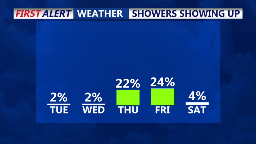
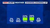
Looking ahead, high pressure will begin retreating by Thursday, making way for a weak system that could bring light showers to parts of the region. However, most of the week will remain dry, with moderating temperatures as we head into the weekend.