


DELMARVA - After a windy start to the weekend, northwest winds will persist throughout Saturday, gusting between 25 and 35 mph at times. Despite the breeze, skies will remain mostly clear, with high temperatures in the upper 40s to low 50s. The dry air moving in will help keep any precipitation at bay, but it will also create an increased fire weather risk in some areas.
By Saturday night, winds will begin to diminish, setting up a calmer evening. Overnight temperatures will dip into the mid-30s, with mostly clear skies. Remember to set your clocks ahead an hour before bed—daylight saving time begins at 2 a.m. Sunday.
Sunday: A Gradual Warmup Begins
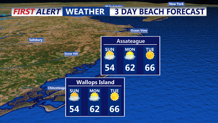
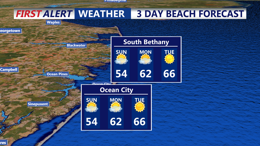
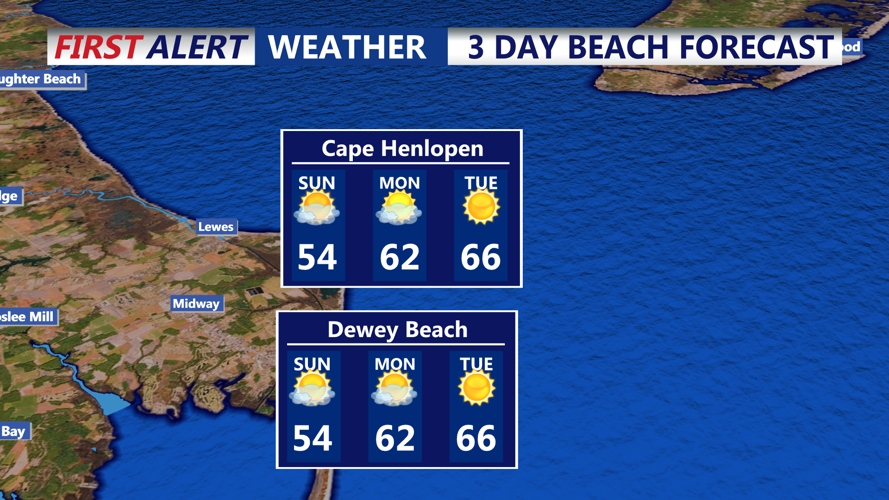
Sunday will feel noticeably milder as winds ease and temperatures climb into the mid-50s. While some high clouds may drift through the area, no precipitation is expected. The wind will still be present, though much lighter than Saturday, making for a more comfortable day outdoors.
With a dry air mass in place, expect a cool but pleasant Sunday night. Overnight lows will settle into the mid-to-upper 30s, but a steady warming trend will continue into Monday.
Early Monday Morning: A Taste of Spring on the Way
By early Monday, temperatures will already be on the rise. A shift in wind direction will allow for milder air to move in, pushing daytime highs close to 60 degrees by the afternoon. Expect some increasing clouds, but conditions will remain dry to start the week.
Looking Ahead: A Brief Warm Spell Before the Next Front
Sussex County will enjoy mild temperatures through early next week, with highs running about 10 degrees above average by Monday afternoon. However, another cold front is on the horizon for midweek, bringing the potential for scattered showers and another cooldown.
For now, the weekend’s highlights—gusty but dry conditions on Saturday, a gradual warmup Sunday, and don’t forget to spring forward Saturday night!
