




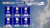
Dry and breezy weather will dominate Wednesday before clouds increase and a cold front approaches early Thursday.
From
To

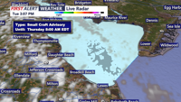
Dry weather continues through Wednesday, with increasing winds and warmer temperatures ahead of a Thursday cold front.

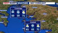
Sussex County faces cooler weather, increasing rain chances and dangerous rip currents from late Thursday night through late Friday night.


Sussex County will wake up cooler Thursday with clouds, northeast winds and scattered showers that may linger into early Friday.


Showers and a possible thunderstorm may linger late Saturday before fog and low clouds develop overnight, followed by a milder and mainly dry Sunday in Sussex County.


Showers are expected to spread across Sussex County on Saturday, with an afternoon thunderstorm possible before fog and low clouds develop early Sunday.

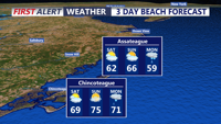
A few showers may linger late Friday before rain becomes more widespread Saturday, with a chance of thunderstorms and locally heavier downpours.

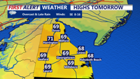
Sussex County stays mainly quiet late Tuesday night before showers increase Wednesday evening with a low risk of a strong storm.

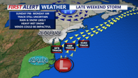
Skies brighten and winds ease Saturday across Sussex County and the Ocean City area, but clouds thicken Saturday night with rain arriving toward daybreak Sunday as storm and marine watches sit in the background for later Sunday.

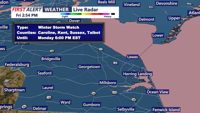
Low clouds and patchy fog linger late Friday as small-craft conditions continue offshore, then Saturday turns calmer and milder — a short window to get ready for a wintry, windy system set to arrive Sunday into Monday.